
Item number: CAN388
Genuine Antique Map
1912
Maker: Boston & Maine Railroad
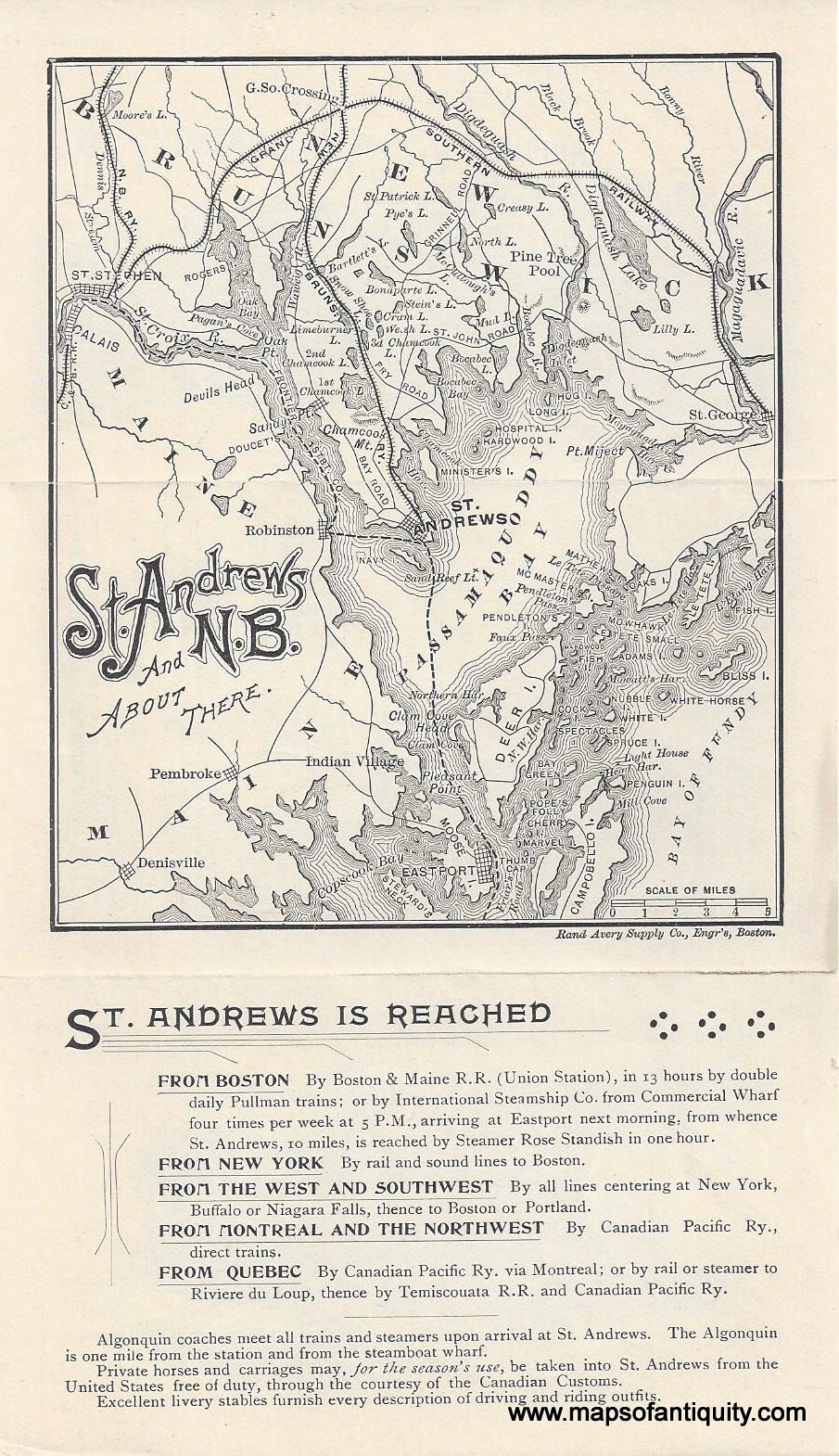
Antique map of St Andrews Bay in Eastern Canada published by the Boston and Maine Railroad, c. 1912. St Andrews is in New Brunswick, on the Passamaquoddy Bay between Maine and Nova Scotia. This map is a tourism promotion for the Algonquin Hotel and seems to have been published after the second addition to the hotel. The original building had 80 rooms and additions were built in 1908 and 1912. The entire hotel, except for the two later wings, succumbed to a 1914 fire and was destroyed. It was rebuilt on the same footprint in a tudor style, quite different from the image on the pamphlet. Very good condition with folds as issued. Measures approx. 8 x 4.5 inches to the paper edges.
Item Number: CAN388