|
We have enjoyed a few beautiful Spring days on Cape Cod, with warmer temperatures, sunshine, and longer days that encourage spending time outdoors. The daffodils are out and the hyacinths are scenting the air! It's been a long winter, and we are looking forward to welcoming back the warmer weather and visitors!
Spring on Cape Cod can be a lovely, romantic escape! Chatham is a perfect location to stay if you will be going to the Nantucket Daffodil Festival (April 24-26) or Brewster in Bloom (May 1-3)! Our Main Suite has a wood burning fireplace if it's chilly after a day out on the town. We have availability in our guest rooms if you fancy a getaway. Our bookings for Summer are starting to come in and some weekends are filling up - book early to avoid disappointment.
|
|
|
Below, we shall highlight some exciting new maps and prints, but you can always visit our Newly Listed Maps section to see everything from the past month or so. We have a Great Maps - Super Deals category that offers our discounted items. And don't forget that we also have a category specifically for maps under $100!
If you are looking for something specific, we recommend using the search function or the "Filter By" function on the left side above the listings to search within a category.
~Gmail users: be sure to click "View entire message" at the bottom of the email so you don't miss anything! Or, if you see three dots (... or ellipsis) in the middle of a message, click on them to expand the content to view it.
|
|
|
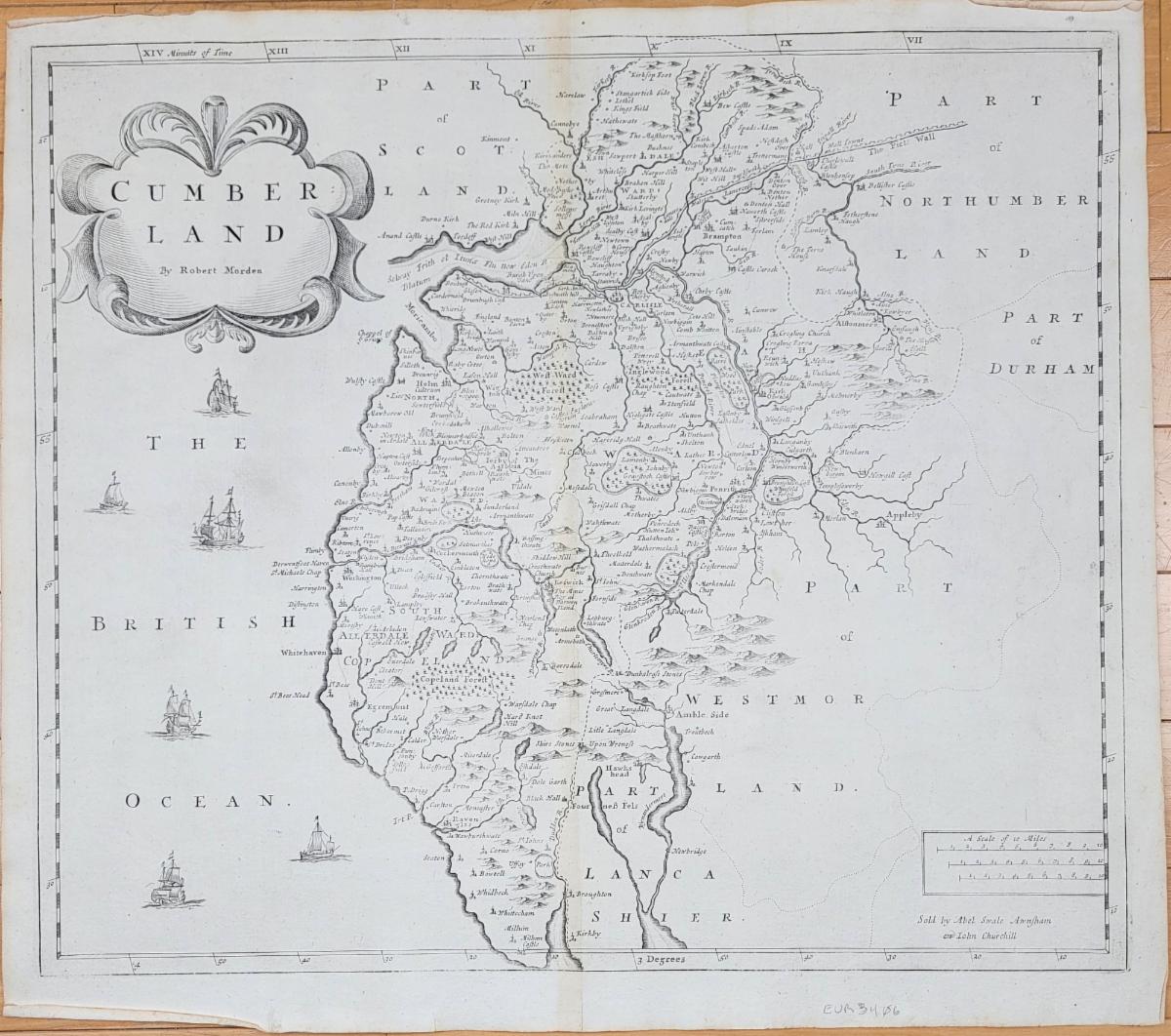
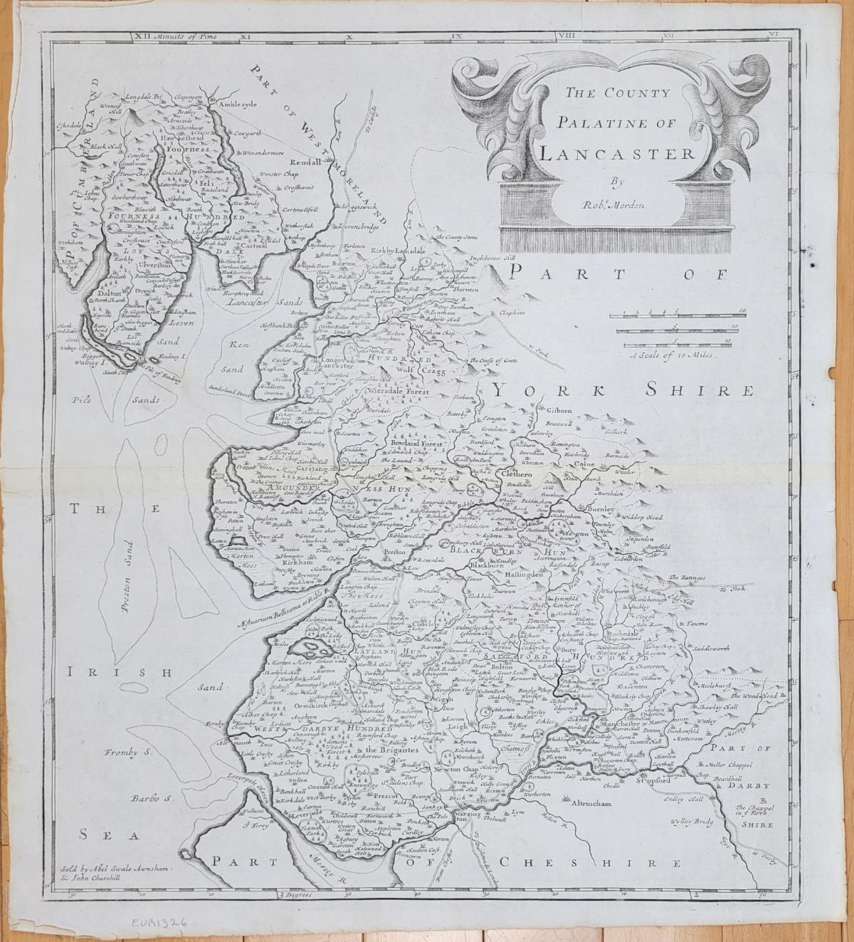
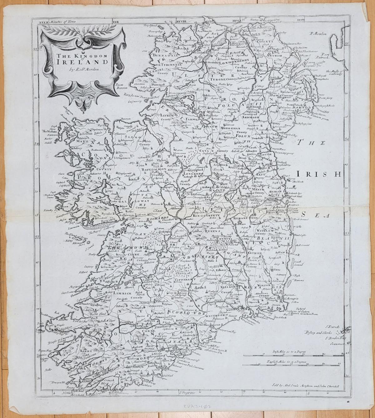
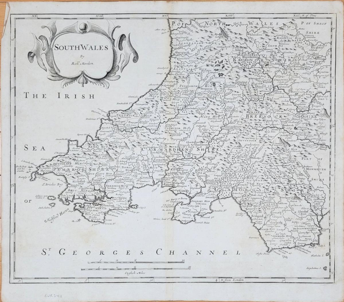
These maps by Robert Morden were published in William Camden's Britannia: Or a Chorographical Description of Great Britain and Ireland Together with the Adjacent Islands... Maps from the 18th Century happen to be Perri's favorites because they are generally cartographically accurate and recognizable while still being visibly hand-etched onto the copper printing plates. The lettering on maps of the 18th Century has a distinct charm that was lost as printmaking technology progressed.
|
|
|
England - Cumberland - Genuine Antique Map from 1722
|
|
|
1722 - England - The County Palatine of Lancaster - Antique Map
|
|
|
1722 - The Kingdom of Ireland - Genuine Antique Map
|
|
|
1722 - South Wales - Genuine Antique Map
|
|
|
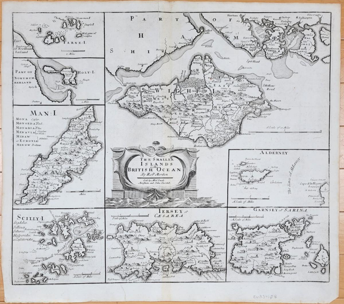
1722 - The Smaller Islands in the British Ocean - Genuine Antique Map
|
|
|
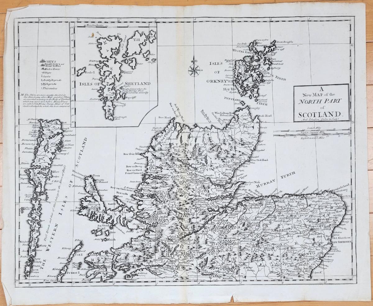
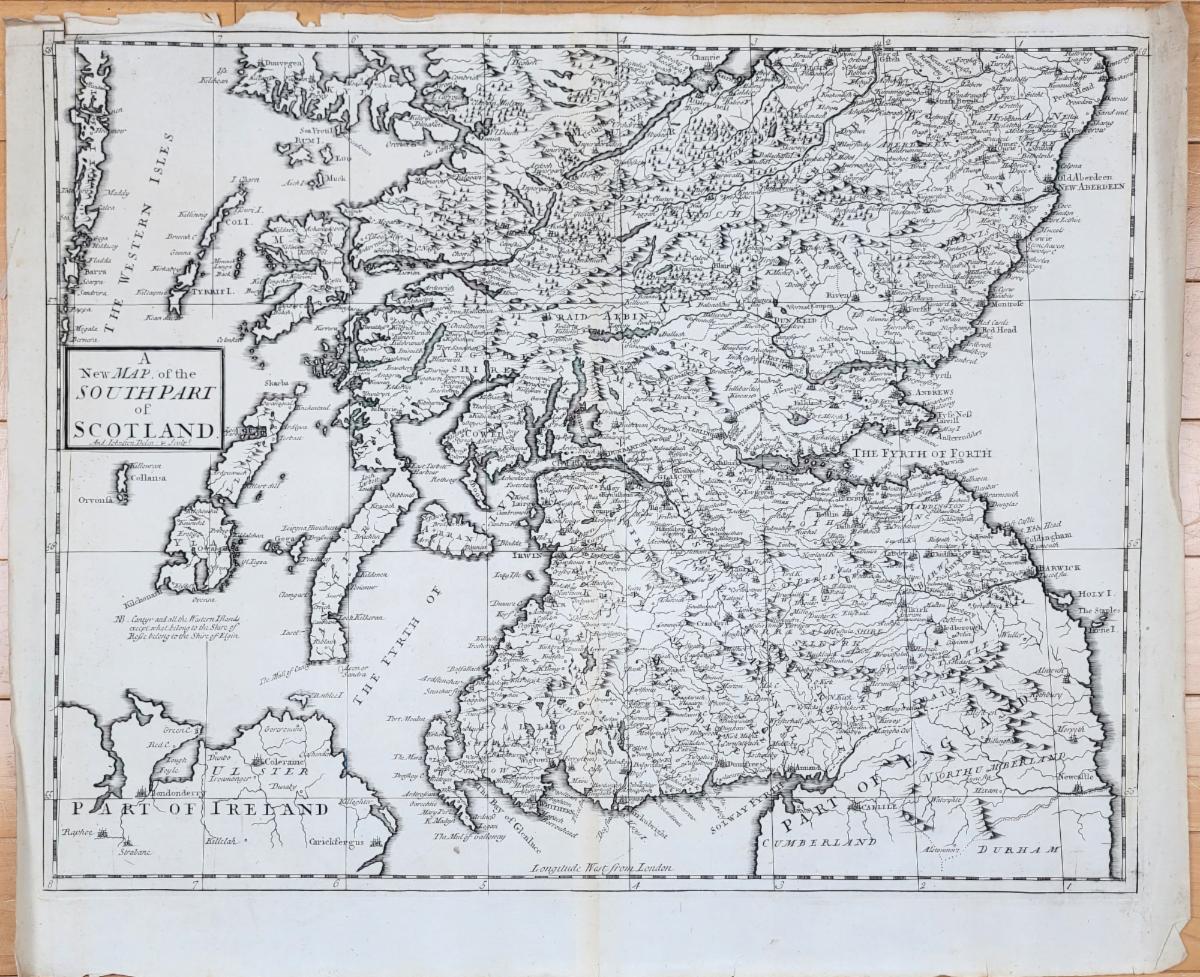
These two maps of Scotland are actually not Morden maps- they are Johnston maps- but they were also in some editions of Britannia
|
|
|
1722 - A New Map of the North Part of Scotland - Genuine Antique Map
|
|
|
1722 - A New Map of the South Part of Scotland - Genuine Antique Map
|
|
|
Maps of Antiquity's 20th Anniversary!
|
|
|
20 years ago, on August 1st, Bob and Danielle purchased Maps of Antiquity (then located in West Barnstable) from Lynn Vigeant, who had started the business in 1987. To celebrate our anniversary, we will be offering special discounts in every email- just look for our special sea monster to find some monster deals!
|
|
|
Click on the sea monster to browse all the maps on sale!
|
|
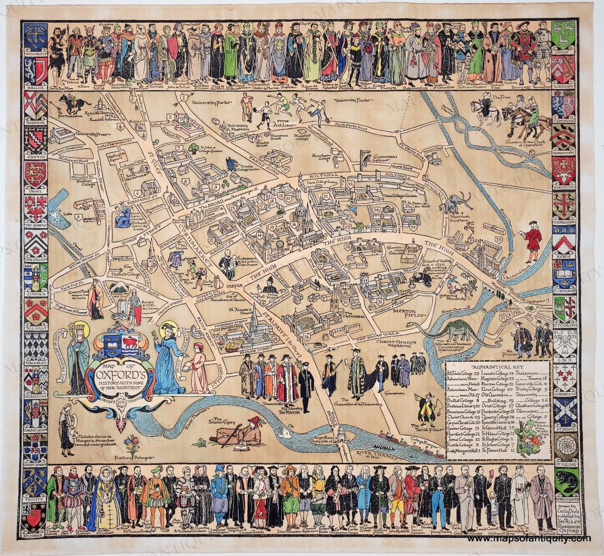
1934 - Map of Oxford's History: With some of its Worthies - Genuine Antique Map
Was $300, now discounted to $250!
|
|
|
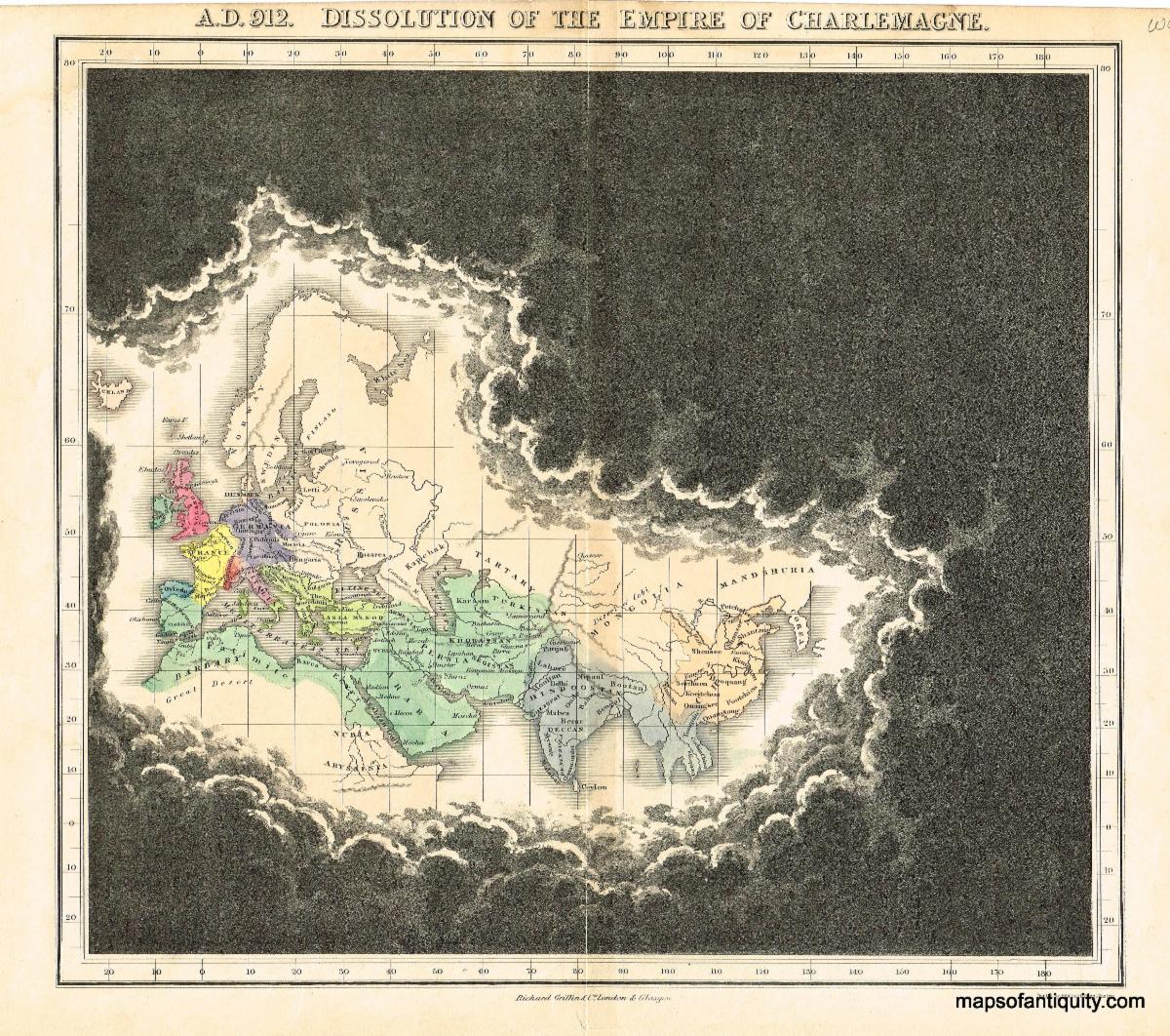
1830 - A.D. 912. Dissolution of the Empire of Charlemagne. - Antique Map
Was $300, now discounted to $150! All of our Quin maps have been discounted!
|
|
|
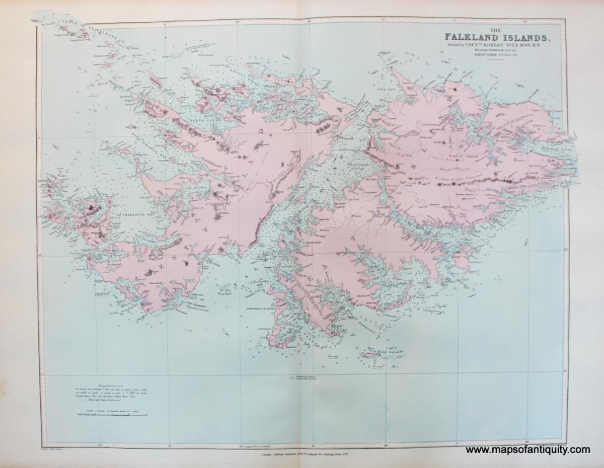
1894 - The Falkland Islands, Surveyed by Capt. Robert Fitz Roy, R.N. - Antique Map
Was $250, now discounted to $150!
|
|
|
Stunning Hardwood Map Case - Antique
Was $375, now discounted to $200!
|
|
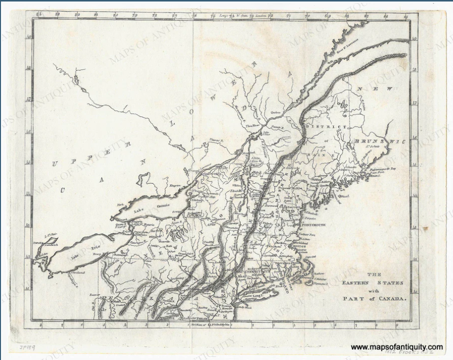
1812 - The Eastern States with Part of Canada. - Antique Map
Was $290, now discounted to $175!
|
|
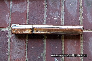
Copper Map Case - Antique
Was $165, now discounted to $110! All of our Map Cases have been discounted!
|
|
|
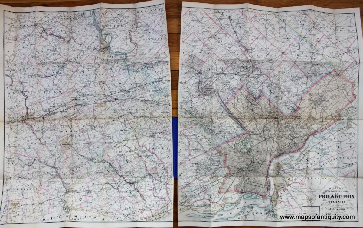
1895 - Smith's Map of Philadelphia and Vicinity - Antique Map
Was $425, now discounted to $275!
|
|
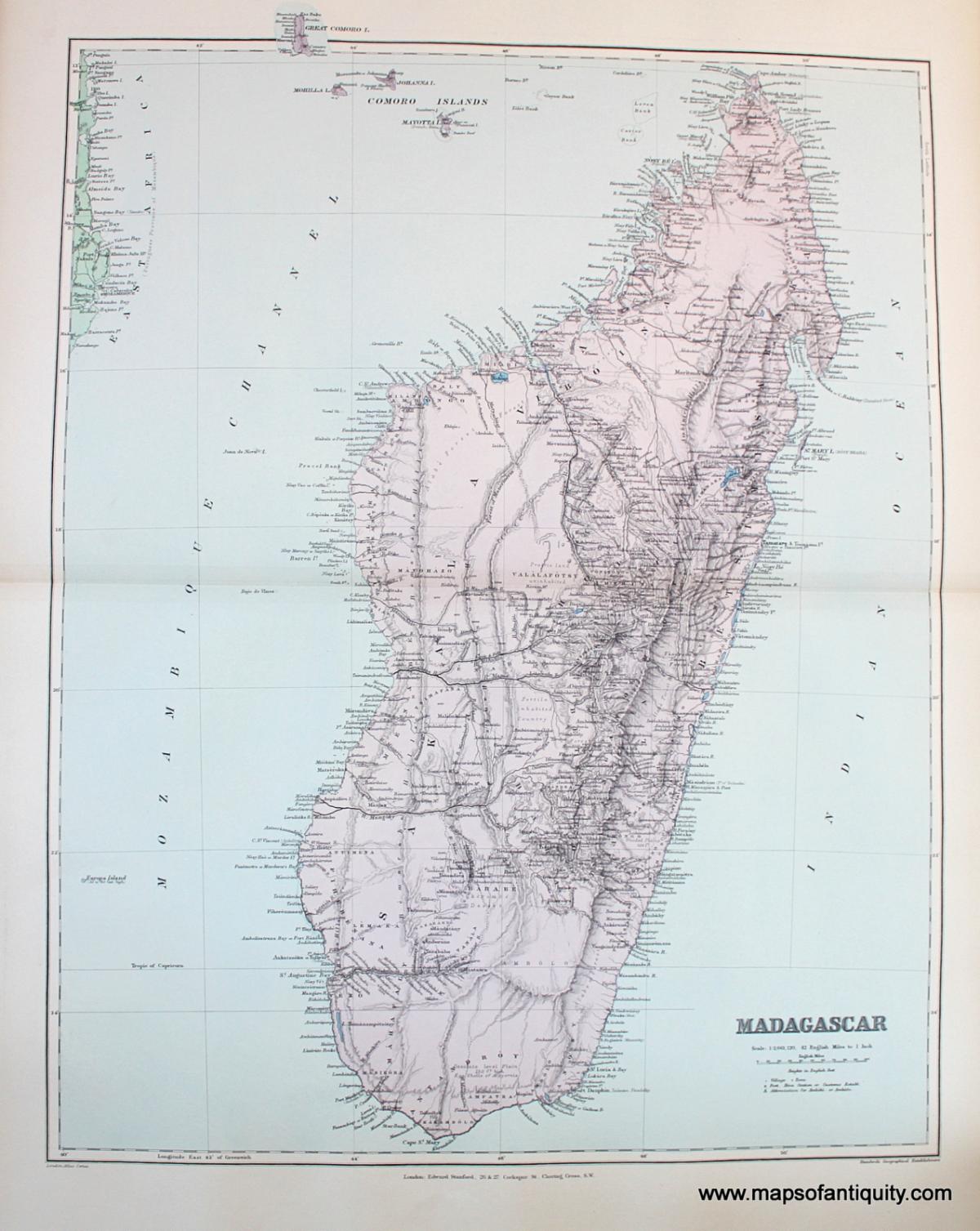
1894 - Madagascar - Antique Map
Was $250, now discounted to $150!
|
|
|
Antique prints bring a unique warmth to home decor, and they cover such a variety of subjects, there is something for everyone! These are just a small selection- we have many more on the website!
|
|
|
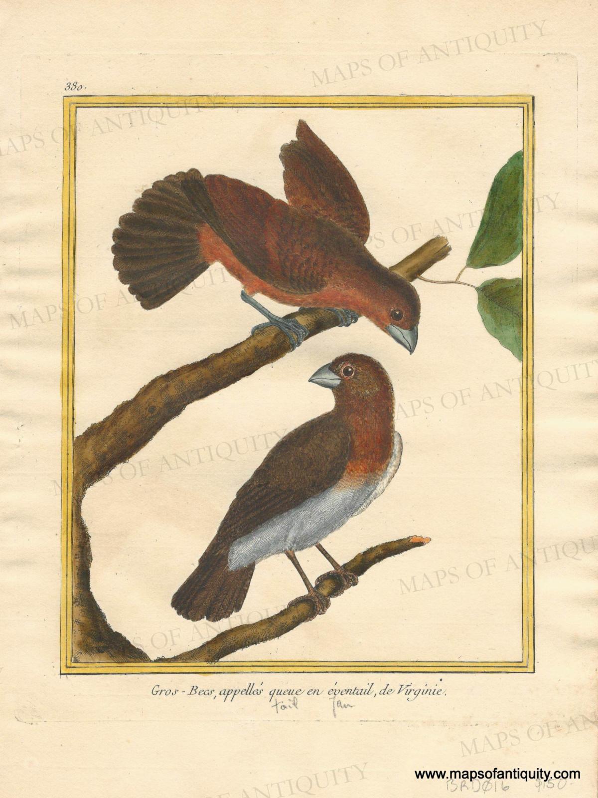
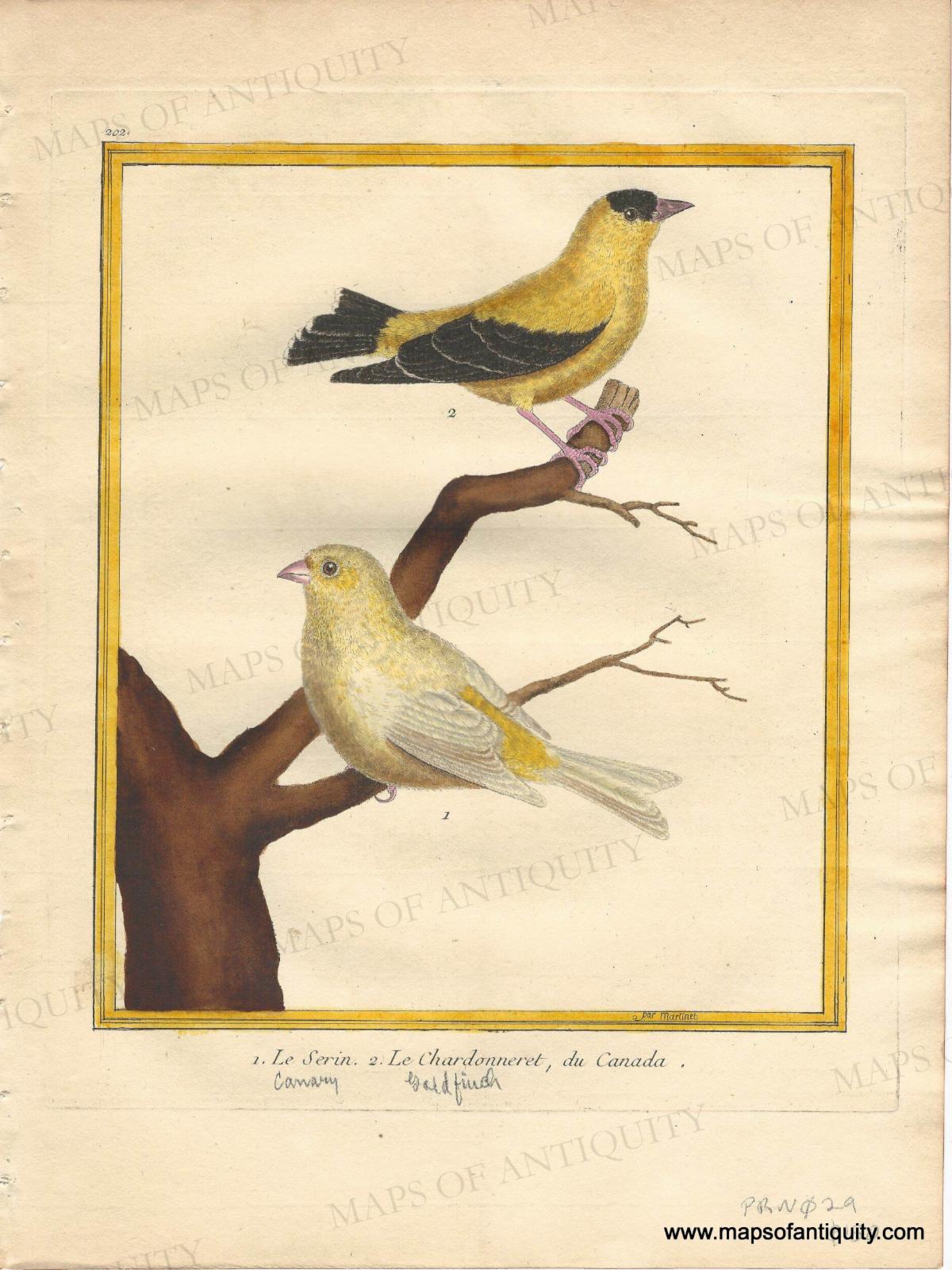
Antique bird prints by Francois Nicolas Martinet published in Planches Enluminées D'Histoire Naturelle, to accompany Buffon's Histoire des Oiseaux, circa 1770
|
|
|
A Unique Map of Manhattan
|
|
|
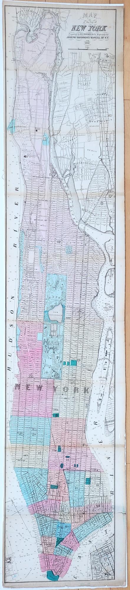
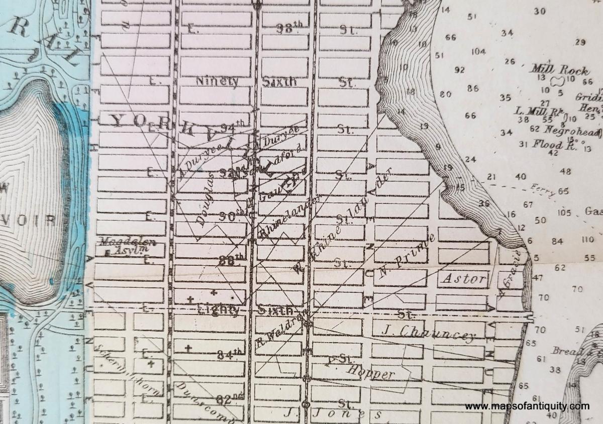
This map was made by W.C. Rogers for Joseph Shannon's Manual of the Corporation of the City of New York, 1868, an annual publication with almanacs, historical facts, New York politics, and public works projects. This early map of New York City’s modern-day grid system also details all of the major landholders and shows Olmstead’s plan for Central Park. This map offers a wealth of historical information with close inspection. Some buildings are noted, including Columbia College at 49th street, as well as various hospitals, asylums, depots, etc.
|
|
|
1868 - Map of the City of New York, Prepared by W.C. Rogers & Co. Expressly for Joseph Shannon's Manual of N.Y. for 1868 - Genuine Antique Map
|
|
|
Close-up to show overlay of street grid with property lots and owners' names
|
|
|
Des Barres Reproduction Charts
|
|
|
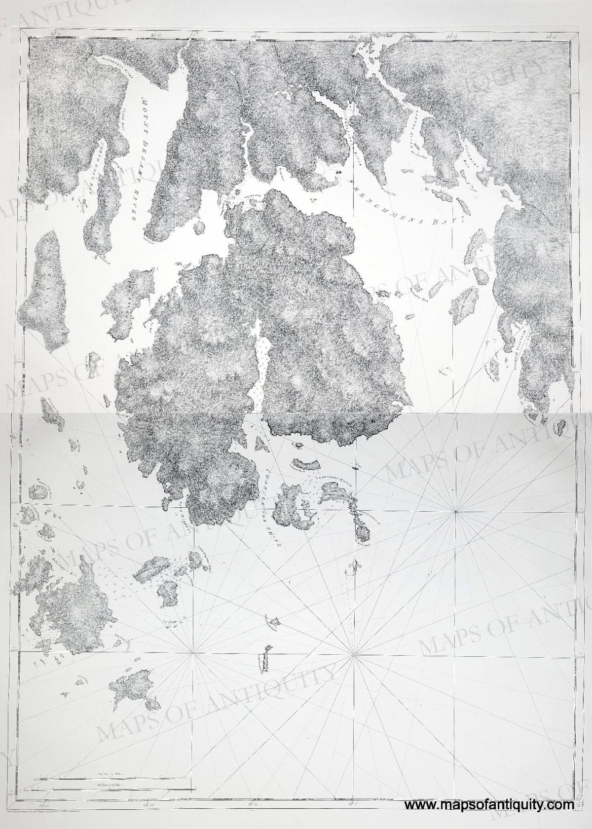
Des Barre's charts were originally published in the Atlantic Neptune in the 1770s. The Atlantic Neptune is a monumental four volume atlas which was the most important collection of maps, charts and views of North America published in the eighteenth century. Colonel Joseph Frederick Wallet Des Barres and Samuel Holland (who surveyed the New England coast), among others, spent years surveying to create the most comprehensive charts of the coast of North America for the British Admiralty, finally published in 1777. Various reproductions have been made, notably the high-quality photogravure reproductions by Barre Publishers in the 1960s. The Massachusetts Historical Society also created restrike charts with the original copperplates in the early 2000s, expertly printed on rag paper, of which the Mount Desert Island charts are an example.
|
|
|
2001 - Des Barres Chart of Mount Desert Island, Maine - Set of Two Restrike Charts (unjoined- this image of the charts joined is an example)
|
|
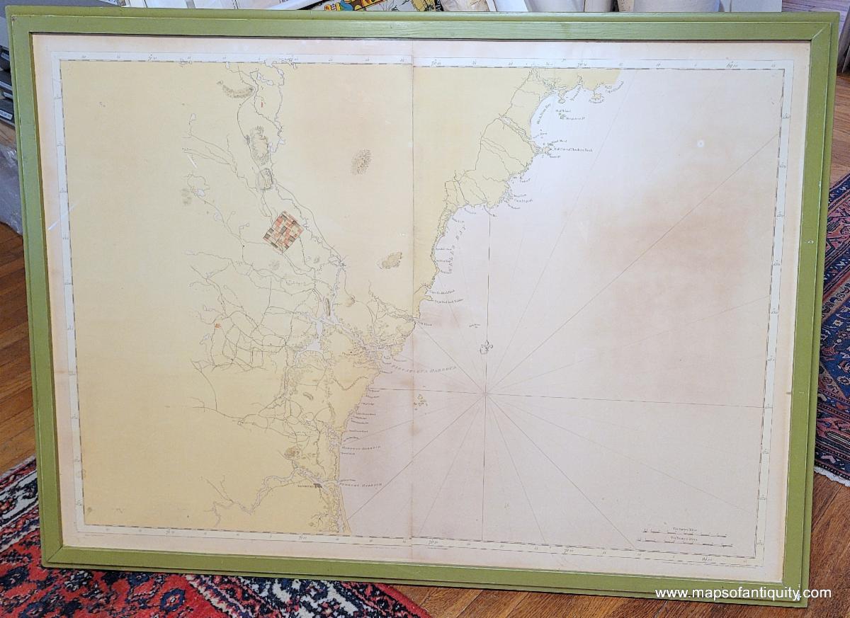
1967 - Des Barres Chart of Portsmouth NH and East Point of Fletchers Neck Maine - Framed Vintage Reproduction (This cannot be shipped as framed)
|
|
|
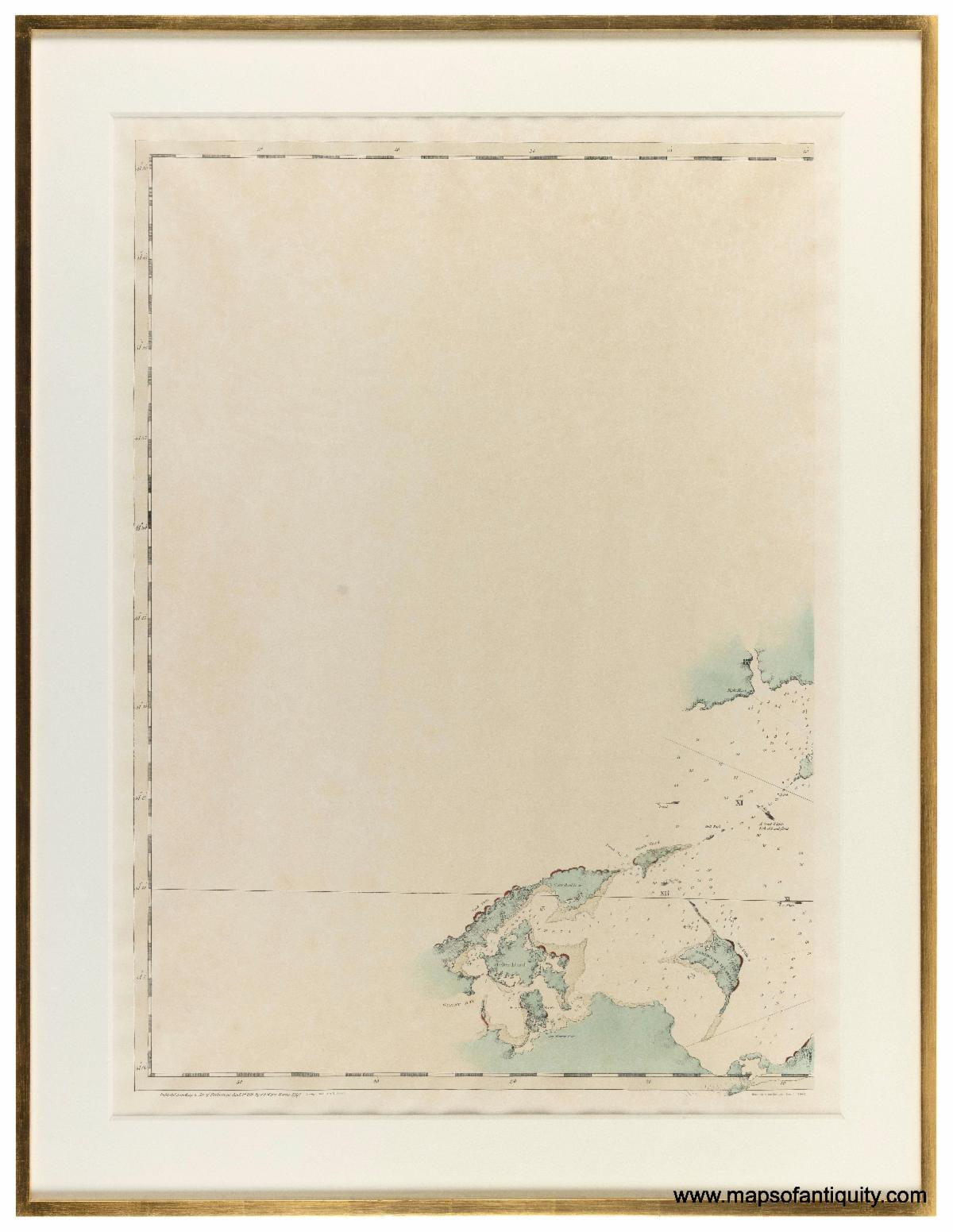
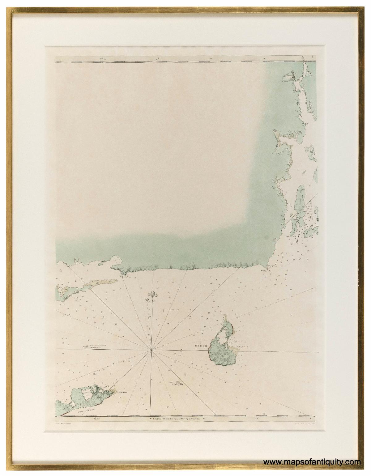
These two charts are contiguous- showing the area from Shelter Island, Long Island to Block Island, Rhode Island. They are for sale separately but are already framed to match and would look great hung together.
1966 - Des Barres Chart of Shelter Island and Environs - Framed Vintage Reproduction
1966 - Des Barres Chart of Block Island and Environs - Framed Vintage Reproduction
|
|
|
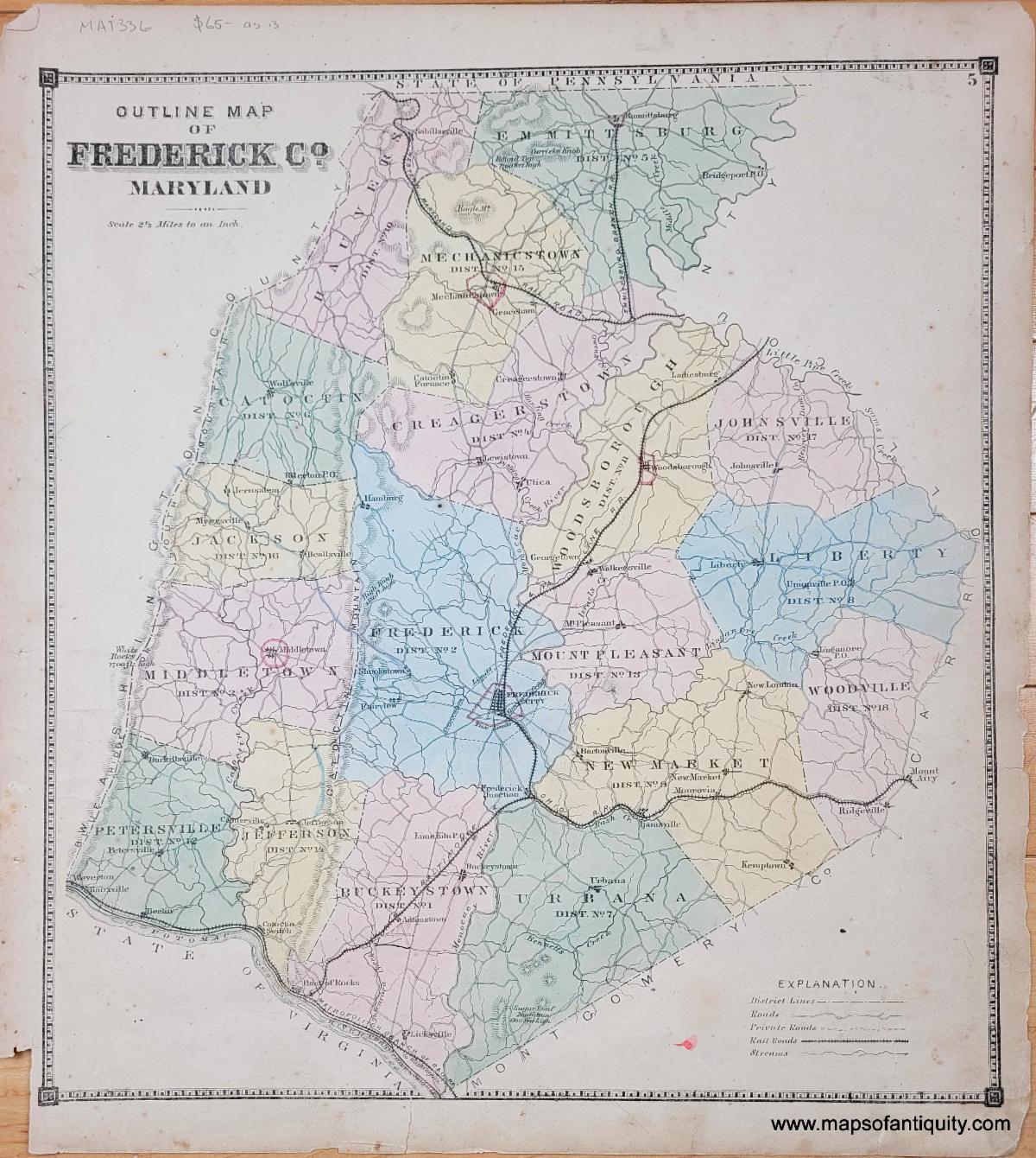
Maps of Frederick County, Maryland
|
|
|
This chart covers the Gulf Coast from the entrance of the Mississippi River to Florida, published by the Hydrographic Office of the US Navy in 1870. New Orleans is included on the left side between the neatline and the graticule line (the striped border line that indicates latitude and longitude). This chart includes Mobile Bay, Pensacola Bay, Santa Rosa Bay, St Andrew's Bay, Apalachicola Bay, Appalachee Bay, Etc.
|
|
|
1870 - The North Coast of the Gulf of Mexico, Sheet 1. From St Marks River to Barataria Bay - Genuine Antique Chart
|
|
|
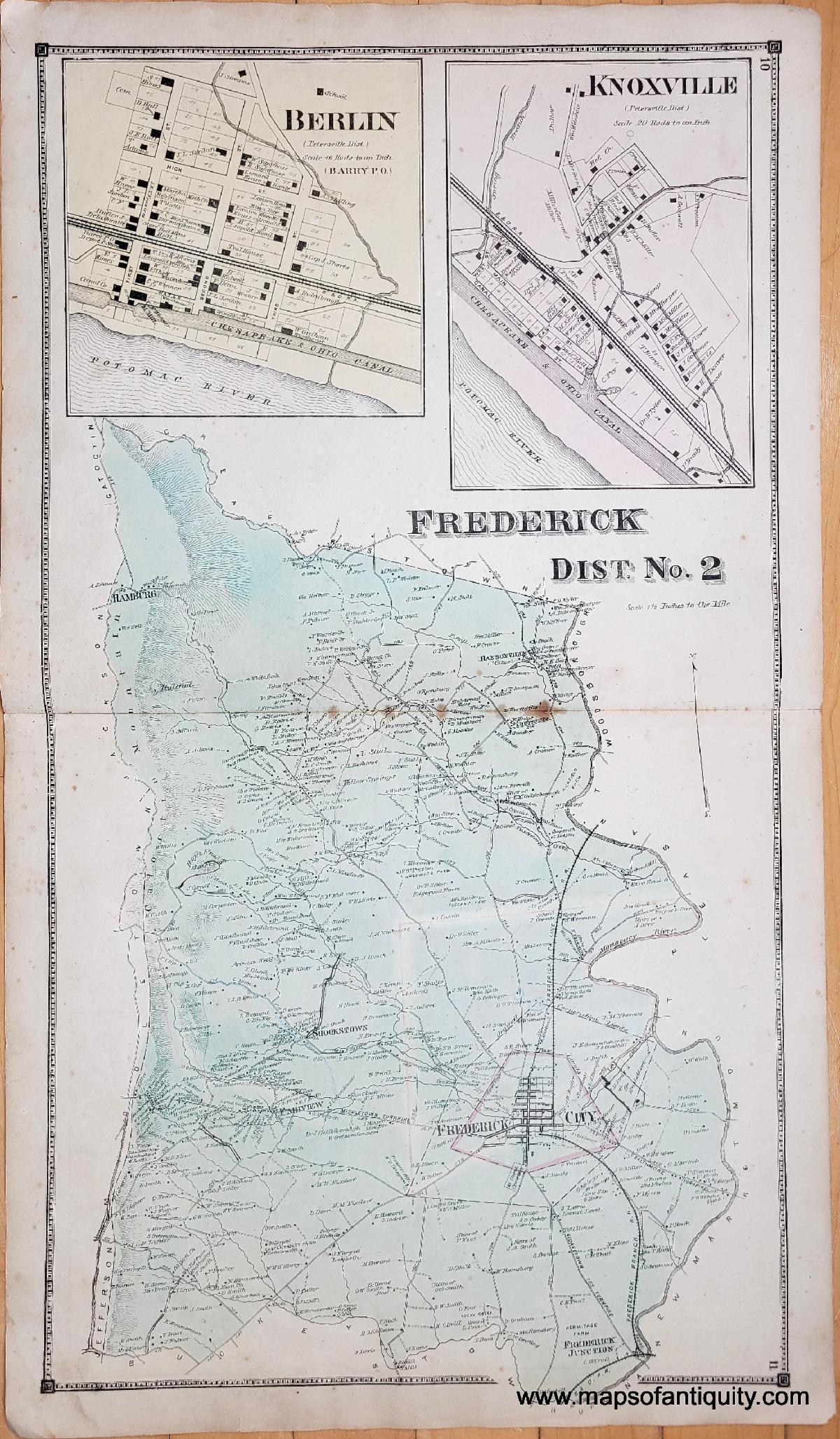
1873 - Frederick Dist. No. 2 (Maryland) - plate 10-11 - Genuine Antique Map
This series also includes ward maps of Frederick City and an outline plan of the city.
|
|
|
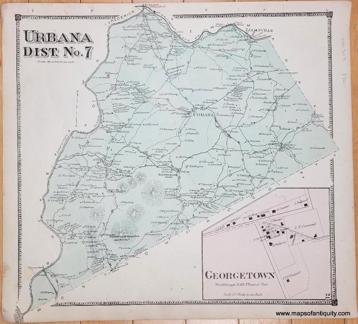
1873 - Urbana Dist. No. 7 (Maryland) - plate 21 - Genuine Antique Map
|
|
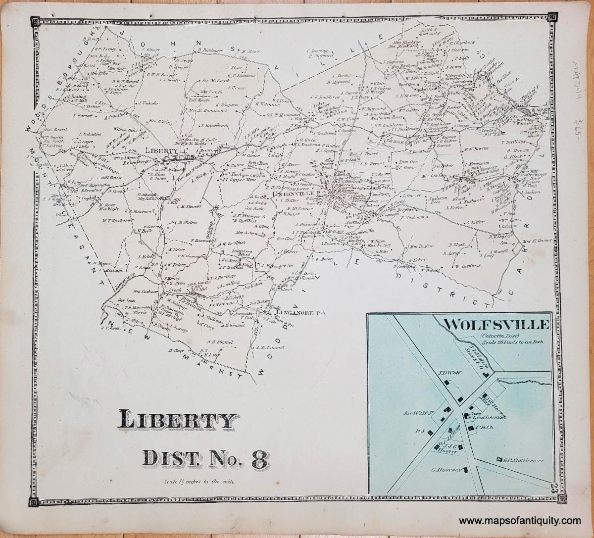
1873 - Liberty Dist No. 8 (Maryland) - plate 23 - Genuine Antique Map
|
|
|
Other Newly Added Antique Items
|
|
|
We wish we could highlight every item newly added to the website, but this email would become overwhelmingly long! Be sure to click the button below to browse every item we have put on our website recently!
|
|
|
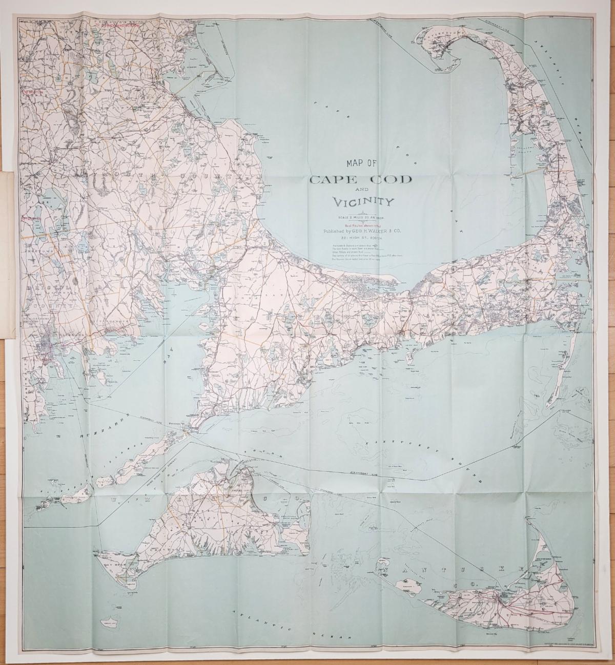
1905 - Map of Cape Cod and Vicinity - Antique Map
|
|
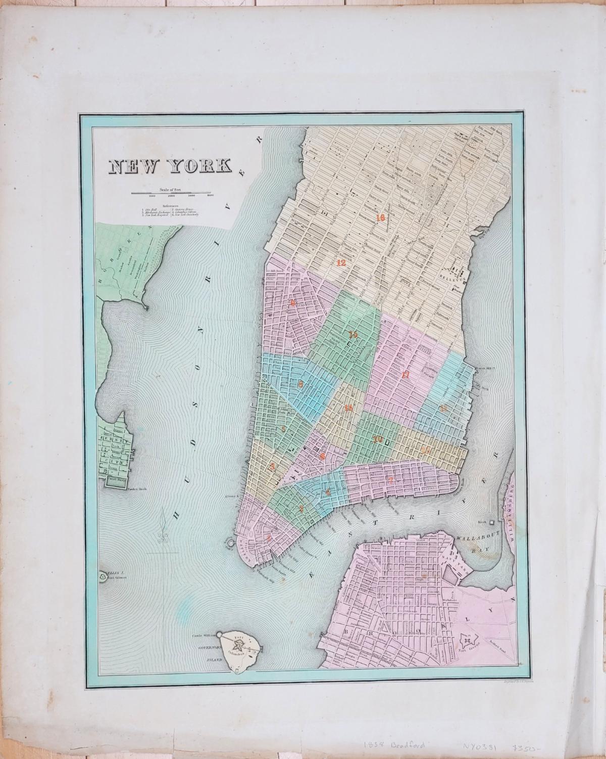
1838 - New York (City)- Antique Map
|
|
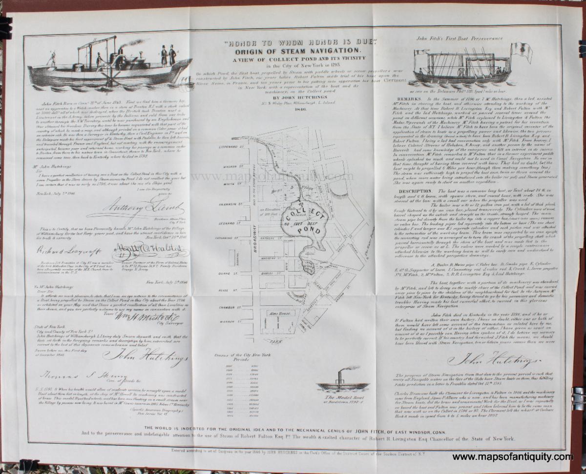
1849 - "Honor to Whom Honor is Due." Origin of Steam Navigation. A View of Collect Pond and its Vicinity in the City of New York in 1793. - Antique Print
Other Pease Documentary History of New York maps can be seen here.
|
|
|
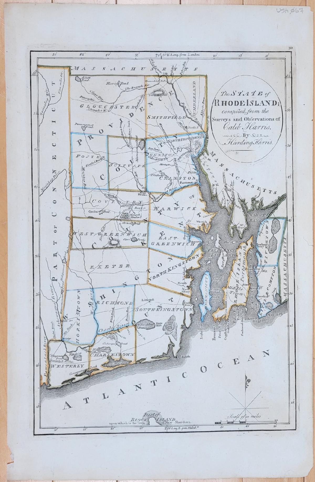
1814 - The State of Rhode Island, compiled from the Surveys and Observations of Caleb Harris. - Antique Map
|
|
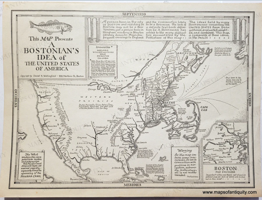
1935 - This Map Presents A Bostonian's Idea of the United States of America - Antique Map
|
|
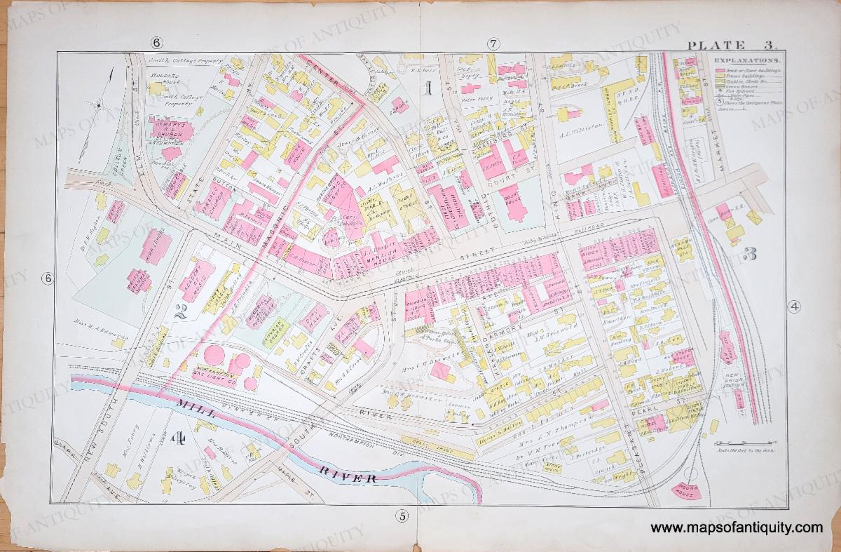
1895 - Plate 3 Part of Northampton MA (near City Hall) - Genuine Antique Map
We have listed several maps from the 1895 Atlas of Northampton and East Hampton [sic]
|
|
|
Our current hours:
Tuesday- Saturday 10am - 5pm.
Closed Sundays and Mondays.
You can shop online any day, any time: mapsofantiquity.com
Or give us a call at: 508-945-1660
If you or your loved-ones need accommodations, send them to our converted 18th century farmhouse, Chatham Guest Rooms. We have been very well reviewed on TripAdvisor!
Visit Old Cape Cod! Book your stay now at Chatham Guest Rooms. The rates are reasonable and you will be staying in the building that is home to Maps of Antiquity. You can pop in to look at maps quite easily during business hours. We rent rooms year 'round!
|
|
|
Maps of Antiquity | 508-945-1660 | 1409 Main St, Chatham MA | Website
|
|
|
|
|