Current hours: 10am to 5pm Monday through Saturday. 12pm to 5pm Sundays. IMPORTANT PLEASE NOTE: We have become aware that some of our photos have been stolen by other websites. Our maps are only available at our website www.mapsofantiquity.com or at our store!

Genuine-Antique-Map-Map-of-Part-of-the-Western-Coast-of-Africa-Extending-from-the-Isles-de-Loss-to-Sherboro-Island.-Particularly-Exhibiting-the-Discoveries-Lately-Made-to-the-N.-E.-of-Sierra-Leone-by-Surgeon-O'Beirne-and-Major-Laing-Africa--1846-Wyld-Maps-Of-Antiquity-1800s-19th-century
1846 - Map of Part of the Western Coast of Africa Extending from the Isles de Loss to Sherboro Island. Particularly Exhibiting the Discoveries Lately Made to the N. E. of Sierra Leone by Surgeon O'Beirne and Major Laing - Antique Map
  • Load image into Gallery viewer, Genuine-Antique-Map-Map-of-Part-of-the-Western-Coast-of-Africa-Extending-from-the-Isles-de-Loss-to-Sherboro-Island.-Particularly-Exhibiting-the-Discoveries-Lately-Made-to-the-N.-E.-of-Sierra-Leone-by-Surgeon-O'Beirne-and-Major-Laing-Africa--1846-Wyld-Maps-Of-Antiquity-1800s-19th-century
  • Load image into Gallery viewer, 1846 - Map of Part of the Western Coast of Africa Extending from the Isles de Loss to Sherboro Island. Particularly Exhibiting the Discoveries Lately Made to the N. E. of Sierra Leone by Surgeon O'Beirne and Major Laing - Antique Map
  • Load image into Gallery viewer, 1846 - Map of Part of the Western Coast of Africa Extending from the Isles de Loss to Sherboro Island. Particularly Exhibiting the Discoveries Lately Made to the N. E. of Sierra Leone by Surgeon O'Beirne and Major Laing - Antique Map
  • Load image into Gallery viewer, 1846 - Map of Part of the Western Coast of Africa Extending from the Isles de Loss to Sherboro Island. Particularly Exhibiting the Discoveries Lately Made to the N. E. of Sierra Leone by Surgeon O'Beirne and Major Laing - Antique Map

1846 - Map of Part of the Western Coast of Africa Extending from the Isles de Loss to Sherboro Island. Particularly Exhibiting the Discoveries Lately Made to the N. E. of Sierra Leone by Surgeon O'Beirne and Major Laing - Antique Map

Regular price
$525.00
Sale price
$525.00
Regular price
Sold out
Unit price
per 
Shipping calculated at checkout.

Item number: AFR273
Genuine Antique Map

1846

Maker: Wyld.

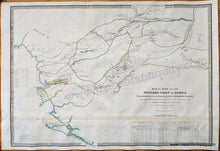
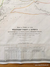
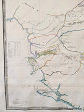
Antique hand colored map of part of Africa published by James Wyld, 1846. This is one of the best known early maps of the British colony of Sierra Leone. Shows area from Isles de Los to Sherbro Island including parts of modern day Guinea and Sierra Leone. This map shows the extent of the knowledge that the British had in this area at this time. The routes of four expeditions are shown. Includes some topography, as well as a chart in the lower right. The title is shortened due to space on our website: "Discoveries Lately Made to the N. E. of Sierra Leone by Surgeon O'Beirne and Major Laing." Very good restored condition. Map has been deacidified and rebacked. Some signs of age remain including mild stains and creases. Paper is slightly wavy. Measures approx. 25.25 x 36 inches.

Item Number: AFR273