1835
Maker: Sidney Hall.
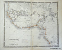
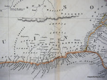
Engraved Antique hand colored map of Western Africa, showing rivers, bodies of water, mountains, and towns, mainly along the rivers and coasts, with vast areas of unmapped territory in the interior. The "Sahara Great Desert" runs along the top edge and the northern edge of Congo marks the bottom of the map, with most non-coastal routes running inland along the Gambia and Niger Rivers. Includes a Reference to the Routes of various explorers from 1795 through 1930, and many fascinating notations of the time throughout the map itself. Very good condition with minor soiling and center crease, measures approximately 16.5 x 20 inches.
Item Number: AFR112


