Winter hours: Tuesday - Saturday 10am to 5pm. Close Sundays and Mondays until May. We appreciate your business!

Antique-Map-Sketch-H-Showing-the-Progress-of-the-Survey-in-Section-No.-8-U.S.-Coast-Survey-Coastal-Chart-Nautical-Charts-Louisiana-Mississippi-Alabama-Gulf-of-Mexico-South-Southern-United-States-America-1846-1854-1850s-1800s-Mid-19th-Century-Maps-of-Antiquity
  • Load image into Gallery viewer, Antique-Map-Sketch-H-Showing-the-Progress-of-the-Survey-in-Section-No.-8-U.S.-Coast-Survey-Coastal-Chart-Nautical-Charts-Louisiana-Mississippi-Alabama-Gulf-of-Mexico-South-Southern-United-States-America-1846-1854-1850s-1800s-Mid-19th-Century-Maps-of-Antiquity
  • Load image into Gallery viewer, Antique-Map-Sketch-H-Showing-the-Progress-of-the-Survey-in-Section-No.-8-U.S.-Coast-Survey-Coastal-Chart-Nautical-Charts-Louisiana-Mississippi-Alabama-Gulf-of-Mexico-South-Southern-United-States-America-1846-1854-1850s-1800s-Mid-19th-Century-Maps-of-Antiquity
  • Load image into Gallery viewer, Antique-Map-Sketch-H-Showing-the-Progress-of-the-Survey-in-Section-No.-8-U.S.-Coast-Survey-Coastal-Chart-Nautical-Charts-Louisiana-Mississippi-Alabama-Gulf-of-Mexico-South-Southern-United-States-America-1846-1854-1850s-1800s-Mid-19th-Century-Maps-of-Antiquity

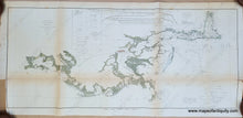
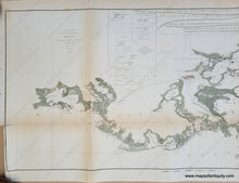
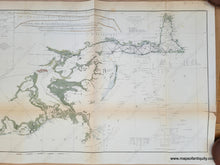
1854 - Gulf of Mexico Vermillion Bay to Mobile Bay - Sketch H. Showing the Progress of the Survey in Section No. 8, 1846-1854 - Antique Chart

Regular price
$175.00
Sale price
$175.00
Regular price
Sold out
Unit price
per 
Shipping calculated at checkout.

Item number: SOU375C
Genuine Antique Hand-Colored Coastal Chart

1854

Maker: U.S. Coast Survey.


Antique hand-colored coastal report chart of the coasts of Louisiana, Mississippi, and Alabama, published by the United States Coast Survey, 1854. Includes New Orleans, Lake Maurepas, Lake Pontchartrain, Lake Borgne, Chandeleur Sound, Isle au Breton Sound, The Mississippi River (including the Delta of the Mississippi showing Oyster Bay, Bay Ronde, Blind Bay, Garden Island Bay, East Bay, etc.), the Mississippi Sound, Bon Secours Bay, Mobile Bay, Lake Ouatache, Barataria Bay, Timballier Bay, Terrebonne Bay, Caillou Bay, Atchafalaya Bay, Vermillion Bay, Grand Lake, and other surrounding waters. Features information regarding lighthouses, astronomical stations, magnetic stations, current stations, and tidal stations, etc. At top is a chart showing "Profiles of Bottom" of the Gulf of Mexico between various points as marked on the map. Also at top is a chart showing the positions of temperature observations south of the Delta of the Mississippi. With folds, as issued. Very good overall antique condition with some mild toning throughout that is slightly darker at folds, and some spots. Measures approximately 14.5" x 26.5" to the neatline.  


Item Number: SOU375C