Current hours: 10am to 5pm Monday through Saturday. 12pm to 5pm Sundays. We are CLOSED on Christmas Day and New Years Day. We will close early (3pm) on Christmas Eve. IMPORTANT PLEASE NOTE: We have become aware that some of our photos have been stolen by other websites. Our maps are only available at our website www.mapsofantiquity.com or at our store!

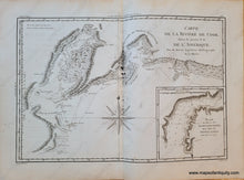
1787 - Carte De La Riviere Cook Dans Partie N.o. L’amerique. Antique Map Genuine
  • Load image into Gallery viewer, 1787 - Carte De La Riviere Cook Dans Partie N.o. L’amerique. Antique Map Genuine
  • Load image into Gallery viewer, 1787 - Carte De La Riviere Cook Dans Partie N.o. L’amerique. Antique Map Genuine

1787 - Carte de la Riviere de Cook, dans la partie N.O. de l'Amerique. - Antique Map

Regular price
$195.00
Sale price
$195.00
Regular price
Sold out
Unit price
per 
Shipping calculated at checkout.

Item number: USA283

Genuine Antique Map

1787

Maker: Bonne and Desmarest.


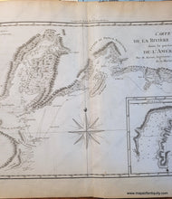
Antique uncolored map of part of southern Alaska from Cook Inlet, which goes almost to where Anchorage is today, to Controller Bay and Kayak Island, showing the path of Captain Cook's exploration, by Bonne and Desmarest, published in the 1787 Atlas Encyclopedique. Includes an inset map titled Plan du Havre de Samgano Odha, dans l'Isle de Oonalaska (part of Unalaska). Very good condition with light image transfer, small tear at bottom in margin, and a few light spots/stains. The black marks in the larger image were removed after the photo was taken, see second photo. Approx. 9.25 x 13.5 inches to the neatlines. 


Item Number: USA283