Current hours: 10am to 5pm Monday through Saturday. 12pm to 5pm Sundays. We are CLOSED on Christmas Day and New Years Day. We will close early (3pm) on Christmas Eve. IMPORTANT PLEASE NOTE: We have become aware that some of our photos have been stolen by other websites. Our maps are only available at our website www.mapsofantiquity.com or at our store!

Genuine-Antique-Map-Map-of-Alaska-1898-General-Land-Office-Maps-Of-Antiquity
1898 - Map Of Alaska Antique Genuine
  • Load image into Gallery viewer, Genuine-Antique-Map-Map-of-Alaska-1898-General-Land-Office-Maps-Of-Antiquity
  • Load image into Gallery viewer, 1898 - Map Of Alaska Antique Genuine
  • Load image into Gallery viewer, 1898 - Map Of Alaska Antique Genuine
  • Load image into Gallery viewer, 1898 - Map Of Alaska Antique Genuine
  • Load image into Gallery viewer, 1898 - Map Of Alaska Antique Genuine
  • Load image into Gallery viewer, 1898 - Map Of Alaska Antique Genuine

1898 - Map of Alaska - Antique Map

Regular price
$350.00
Sale price
$350.00
Regular price
Sold out
Unit price
per 
Shipping calculated at checkout.

Item number: WES541
Genuine Antique Map

1898

Maker: General Land Office

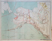
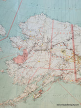
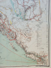
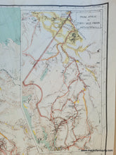
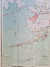
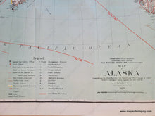
Antique map of Alaska, published by the Department of the Interior, General Land Office in 1898. Includes an inset map from Juneau to Forty Mile Creek with the Klondike Region and another inset of the Aleutian Islands. Divided by Districts, showing the monthly mail route by sea in red. A table of dinsantces at the lower right and a legend at bottom. Indicated on the map are routes, proposed railroads, areas where gold was reported, other mineral deposits, and Missions for a variety of faiths. Very good antique condition with folds as issued. This was printed by the Norris Co using a photolitho process. Measures approx. 24.75 x 32.25 inches to the neatline.

Item Number: WES541