1845
Maker: Ensign.
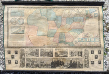
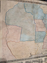
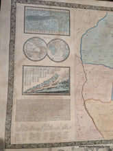
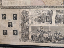
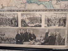
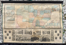
Charming and unusual antique wall map and "Travellers' Guide" of the United States in 1845, including insets the vicinities of New York City, Philadelphia, Boston, Baltimore, New Orleans, Mobile, Cincinnati, St. Louis, Charleston, Pittsburgh, Chicago, Detroit, as well as Washington, DC. Shows Texas as a republic according to its early borders and identifies Austin TX as the capitol. Also includes comparative charts of the chief rivers and principal mountains, inset with a map of the world in hemispheres, a copy of the Declaration of Independence, and vignettes and illustrations of the Signing of the Declaration of Independence, the Landing of the Pilgrims on December 22, 1620. the Battle of Lexington, April 19th 1775, the Battle of Bunkers Hill, June 17, 1775, Washington's Farewell to his army, December 4, 1783, and portraits of 11 of the early U.S. Presidents. Good condition with some stains and toning, linen backed, whole, on rods, approximately 25 by 38.5 inches. **NOTE- because this map requires extra insurance for shipping, an additional charge will appear on your card after your original purchase. If you would like to know what that charge will be, please contact us.**
Item Number: USA060


