Massachusetts-Topographic-State-Wall-Map-Fragment-1861-Walling-Nantucket-Martha's-Vineyard-Cape-Cod-Buzzards-Bay-Plymouth-Accushnet-Antique-1860s-1800s-19th-century-Maps-of-Antiquity
  • Load image into Gallery viewer, Massachusetts-Topographic-State-Wall-Map-Fragment-1861-Walling-Nantucket-Martha's-Vineyard-Cape-Cod-Buzzards-Bay-Plymouth-Accushnet-Antique-1860s-1800s-19th-century-Maps-of-Antiquity
  • Load image into Gallery viewer, Massachusetts-Topographic-State-Wall-Map-Fragment-1861-Walling-Nantucket-Martha's-Vineyard-Cape-Cod-Buzzards-Bay-Plymouth-Accushnet-Antique-1860s-1800s-19th-century-Maps-of-Antiquity
  • Load image into Gallery viewer, Massachusetts-Topographic-State-Wall-Map-Fragment-1861-Walling-Nantucket-Martha's-Vineyard-Cape-Cod-Buzzards-Bay-Plymouth-Accushnet-Antique-1860s-1800s-19th-century-Maps-of-Antiquity
  • Load image into Gallery viewer, Massachusetts-Topographic-State-Wall-Map-Fragment-1861-Walling-Nantucket-Martha's-Vineyard-Cape-Cod-Buzzards-Bay-Plymouth-Accushnet-Antique-1860s-1800s-19th-century-Maps-of-Antiquity
  • Load image into Gallery viewer, Massachusetts-Topographic-State-Wall-Map-Fragment-1861-Walling-Nantucket-Martha's-Vineyard-Cape-Cod-Buzzards-Bay-Plymouth-Accushnet-Antique-1860s-1800s-19th-century-Maps-of-Antiquity

1861 - Massachusetts Topographic State Wall Map Fragment - Antique Map

Regular price
$400.00
Sale price
$400.00
Regular price
$950.00
Sold out
Unit price
per 
Shipping calculated at checkout.

Item number: MAS1468

Genuine Antique Hand Colored Map

1861

Maker: Walling.

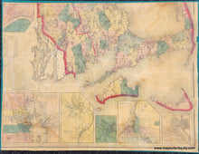
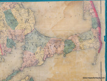
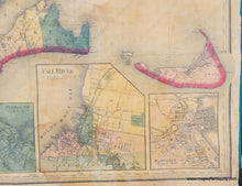
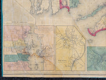
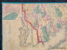
Large fragment of the Topographic Wall Map of Massachusetts by Borden, south east quarter of the map, in fair to good condition showing parts of Bristol, Plymouth and Barnstable Counties plus, Dukes (Martha's Vineyard) and Nantucket Counties. Insets include towns of Nantucket, Fall River, Plymouth, Taunton, New Bedford, Fair Haven, Haverhill, and Oxford. Census and distance tables. Original surface, golden back color on hand colored map. Mounted on linen. Original, unrestored condition, with some stains and cracks in the surface. Measures approx. 27 1/2" x 36 1/2". **NOTE- because this map requires extra insurance for shipping, an additional charge will appear on your card after your original purchase. If you would like to know what that charge will be, please contact us.**

Item Number: MAS1468