Current hours: 10am to 5pm Tuesday through Saturday. We are closed Sundays and Mondays for the Winter. IMPORTANT PLEASE NOTE: We have become aware that some of our photos have been stolen by other websites. Our maps are only available at our website www.mapsofantiquity.com or at our store!

Genuine-Antique-Hand-Colored-Atlas-An-Atlas-accompanying-Worcesters-Epitome-of-Geography-1828-Hunt-Maps-Of-Antiquity
  • Load image into Gallery viewer, Genuine-Antique-Hand-Colored-Atlas-An-Atlas-accompanying-Worcesters-Epitome-of-Geography-1828-Hunt-Maps-Of-Antiquity
  • Load image into Gallery viewer, Genuine-Antique-Hand-Colored-Atlas-An-Atlas-accompanying-Worcesters-Epitome-of-Geography-1828-Hunt-Maps-Of-Antiquity
  • Load image into Gallery viewer, Genuine-Antique-Hand-Colored-Atlas-An-Atlas-accompanying-Worcesters-Epitome-of-Geography-1828-Hunt-Maps-Of-Antiquity
  • Load image into Gallery viewer, Genuine-Antique-Hand-Colored-Atlas-An-Atlas-accompanying-Worcesters-Epitome-of-Geography-1828-Hunt-Maps-Of-Antiquity
  • Load image into Gallery viewer, Genuine-Antique-Hand-Colored-Atlas-An-Atlas-accompanying-Worcesters-Epitome-of-Geography-1828-Hunt-Maps-Of-Antiquity
  • Load image into Gallery viewer, Genuine-Antique-Hand-Colored-Atlas-An-Atlas-accompanying-Worcesters-Epitome-of-Geography-1828-Hunt-Maps-Of-Antiquity
  • Load image into Gallery viewer, Genuine-Antique-Hand-Colored-Atlas-An-Atlas-accompanying-Worcesters-Epitome-of-Geography-1828-Hunt-Maps-Of-Antiquity
  • Load image into Gallery viewer, Genuine-Antique-Hand-Colored-Atlas-An-Atlas-accompanying-Worcesters-Epitome-of-Geography-1828-Hunt-Maps-Of-Antiquity
  • Load image into Gallery viewer, Genuine-Antique-Hand-Colored-Atlas-An-Atlas-accompanying-Worcesters-Epitome-of-Geography-1828-Hunt-Maps-Of-Antiquity
  • Load image into Gallery viewer, Genuine-Antique-Hand-Colored-Atlas-An-Atlas-accompanying-Worcesters-Epitome-of-Geography-1828-Hunt-Maps-Of-Antiquity
  • Load image into Gallery viewer, Genuine-Antique-Hand-Colored-Atlas-An-Atlas-accompanying-Worcesters-Epitome-of-Geography-1828-Hunt-Maps-Of-Antiquity
  • Load image into Gallery viewer, Genuine-Antique-Hand-Colored-Atlas-An-Atlas-accompanying-Worcesters-Epitome-of-Geography-1828-Hunt-Maps-Of-Antiquity

1828 - An Atlas accompanying Worcester's Epitome of Geography - Antique Map

Regular price
$195.00
Sale price
$195.00
Regular price
Sold out
Unit price
per 
Shipping calculated at checkout.

Item number: BKS008
Genuine Antique Hand-Colored Atlas

1828

Maker: Hunt


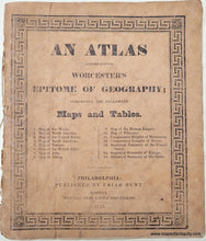
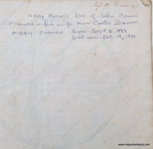
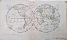
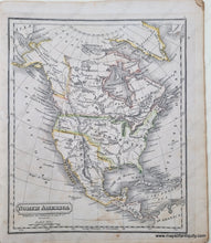
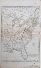
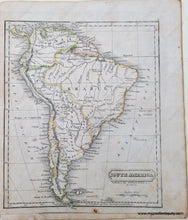
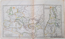
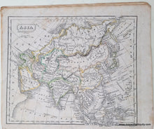
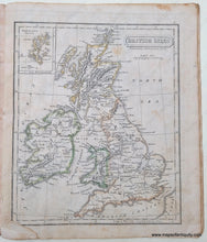
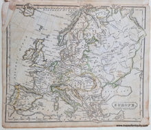
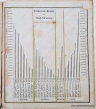
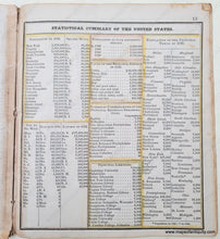
Antique hand-colored atlas published by Uriah Hunt in 1828. Includes fifteen maps and tables, such as a map of the world, North America, Europe, Africa (with unexplored regions noted), Roman Empire, a chart of the comparative heights of mountains, statistical summary of the United States, and more. See the photo of the atlas cover for the complete list. The map of the Roman Empire has a large and notable Armenia, and the North America map shows an interesting time in the development of the boundaries, with Russia claiming a large swath on the west, and Mexico in possession of California, and Maine's border stretching far north. A note at the front of the atlas indicates that it belonged to Miss Abby Francis who was born in 1823. Generally good antique condition. The atlas cover has wear at the spine but remains intact. The maps have some imperfections, including some spots, overall wrinkles, and some have seam separations. See photos. The atlas measures approx. 8 x 6.75 inches.


Item Number: BKS008