Current hours: 10:30am to 5pm Tuesday through Saturday. We are closed Sundays and Mondays for the Winter. IMPORTANT PLEASE NOTE: We have become aware that some of our photos have been stolen by other websites. Our maps are only available at our website www.mapsofantiquity.com or at our store!

Antique-Black-and-White-Map-Historical-Map-of-Nantucket-**********-United-States-Cape-Cod-and-Islands-1880-Ewer-Maps-Of-Antiquity
  • Load image into Gallery viewer, Antique-Black-and-White-Map-Historical-Map-of-Nantucket-**********-United-States-Cape-Cod-and-Islands-1880-Ewer-Maps-Of-Antiquity
  • Load image into Gallery viewer, Antique-Black-and-White-Map-Historical-Map-of-Nantucket-**********-United-States-Cape-Cod-and-Islands-1880-Ewer-Maps-Of-Antiquity

1900 - Historical Map of Nantucket - Antique Map

Regular price
$145.00
Sale price
$145.00
Regular price
$175.00
Sold out
Unit price
per 
Shipping calculated at checkout.

Item number: MAS2254

Genuine Antique Map

c.1900

Maker: Ewer.


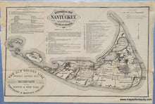
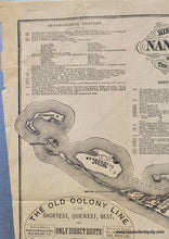
Antique black and white map of Nantucket, by Rev. F.C. Ewer, D.D. originally published as a larger map in 1869, this map was reduced and published in tourism booklets from the 1880s to early 1900s. With historical timelines from the 17th, 18th and 19th Centuries. The last year in the timeline is 1886, so this map was published after that year. Fair to good condition, with a complete tear in the upper left corner that was repaired with tape (probably non-archival), and some other small tears along the folds that we have repaired with archival tape. Tight margins. With folds as issued, 8.5 x 13.5 inches to the neatline. Price reduced for condition.


Item Number: MAS2254