Winter hours: Tuesday - Saturday 10am to 5pm. Close Sundays and Mondays until May. We appreciate your business!

MAS541-Antique-Folding-Road-Map-Come-to-Cape-Cod-Land-of-the-Early-American-c-1930-Cape-Cod-Chamber-of-Commerce-Maps-Of-Antiquity
1930s - Come to Cape Cod, The Land of the Early American - Antique Tourism Booklet with Road Map
  • Load image into Gallery viewer, MAS541-Antique-Folding-Road-Map-Come-to-Cape-Cod-Land-of-the-Early-American-c-1930-Cape-Cod-Chamber-of-Commerce-Maps-Of-Antiquity
  • Load image into Gallery viewer, 1930s - Come to Cape Cod, The Land of the Early American - Antique Tourism Booklet with Road Map
  • Load image into Gallery viewer, 1930s - Come to Cape Cod, The Land of the Early American - Antique Tourism Booklet with Road Map
  • Load image into Gallery viewer, 1930s - Come to Cape Cod, The Land of the Early American - Antique Tourism Booklet with Road Map
  • Load image into Gallery viewer, 1930s - Come to Cape Cod, The Land of the Early American - Antique Tourism Booklet with Road Map

1930s - Come to Cape Cod, The Land of the Early American - Antique Tourism Booklet with Road Map

Regular price
$75.00
Sale price
$75.00
Regular price
Sold out
Unit price
per 
Shipping calculated at checkout.

Item number: MAS541
Genuine Antique Folding Road Map, in Booklet

c. 1930s

Maker: Cape Cod Chamber of Commerce.


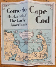
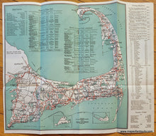
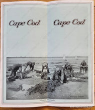
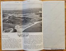
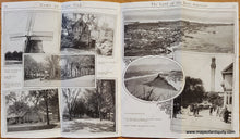
Charming antique folding road map of Cape Cod in vibrant printed color. Red lines show the paved (macadam) roads. Published by the Cape Cod Chamber of Commerce and the Cape Cod, Martha's Vineyard and Nantucket Hotel Associations, 1910-1930. With information on Golf Courses, Hotels, Summer Camps, and Driving Distances. The attached 15 page booklet features another map, a pictorial, on the front, and the pages are filled with delightful photographs of Cape Cod, from the bridges to Provincetown and in between, including a great aerial image of Osterville and Oyster Harbors, and another of the Cotuit area. Very good condition, Booklet has some minor wear at the edges, some wear at the folds, and map has some rusty staples- map could be removed for framing easily by bending the staples open. Map unfolded measures approx. 12.75 x 12.75 inches to the neatline. 


Item Number: MAS541