Current hours: 10:30am to 5pm Tuesday through Saturday. We are closed Sundays and Mondays for the Winter. IMPORTANT PLEASE NOTE: We have become aware that some of our photos have been stolen by other websites. Our maps are only available at our website www.mapsofantiquity.com or at our store!

Black-and-White-Antique-Map-in-Four-Sections-A-Map-of-the-Extremity-of-Cape-Cod-Including-the-Townships-of-Provincetown-&-Truro-with-a-Chart-of-Their-Sea-Coast-and-of-Cape-Cod-Harbour-State-of-Massachusetts.-**********-US-Massachusetts-Cape-Cod-and-Islands-1836-U.S.-Topographical-Engineers-Maps-Of-Antiquity
  • Load image into Gallery viewer, Black-and-White-Antique-Map-in-Four-Sections-A-Map-of-the-Extremity-of-Cape-Cod-Including-the-Townships-of-Provincetown-&-Truro-with-a-Chart-of-Their-Sea-Coast-and-of-Cape-Cod-Harbour-State-of-Massachusetts.-**********-US-Massachusetts-Cape-Cod-and-Islands-1836-U.S.-Topographical-Engineers-Maps-Of-Antiquity
  • Load image into Gallery viewer, Black-and-White-Antique-Map-in-Four-Sections-A-Map-of-the-Extremity-of-Cape-Cod-Including-the-Townships-of-Provincetown-&-Truro-with-a-Chart-of-Their-Sea-Coast-and-of-Cape-Cod-Harbour-State-of-Massachusetts.-**********-US-Massachusetts-Cape-Cod-and-Islands-1836-U.S.-Topographical-Engineers-Maps-Of-Antiquity
  • Load image into Gallery viewer, Black-and-White-Antique-Map-in-Four-Sections-A-Map-of-the-Extremity-of-Cape-Cod-Including-the-Townships-of-Provincetown-&-Truro-with-a-Chart-of-Their-Sea-Coast-and-of-Cape-Cod-Harbour-State-of-Massachusetts.-**********-US-Massachusetts-Cape-Cod-and-Islands-1836-U.S.-Topographical-Engineers-Maps-Of-Antiquity
  • Load image into Gallery viewer, Black-and-White-Antique-Map-in-Four-Sections-A-Map-of-the-Extremity-of-Cape-Cod-Including-the-Townships-of-Provincetown-&-Truro-with-a-Chart-of-Their-Sea-Coast-and-of-Cape-Cod-Harbour-State-of-Massachusetts.-**********-US-Massachusetts-Cape-Cod-and-Islands-1836-U.S.-Topographical-Engineers-Maps-Of-Antiquity
  • Load image into Gallery viewer, Black-and-White-Antique-Map-in-Four-Sections-A-Map-of-the-Extremity-of-Cape-Cod-Including-the-Townships-of-Provincetown-&-Truro-with-a-Chart-of-Their-Sea-Coast-and-of-Cape-Cod-Harbour-State-of-Massachusetts.-**********-US-Massachusetts-Cape-Cod-and-Islands-1836-U.S.-Topographical-Engineers-Maps-Of-Antiquity
  • Load image into Gallery viewer, Black-and-White-Antique-Map-in-Four-Sections-A-Map-of-the-Extremity-of-Cape-Cod-Including-the-Townships-of-Provincetown-&-Truro-with-a-Chart-of-Their-Sea-Coast-and-of-Cape-Cod-Harbour-State-of-Massachusetts.-**********-US-Massachusetts-Cape-Cod-and-Islands-1836-U.S.-Topographical-Engineers-Maps-Of-Antiquity
  • Load image into Gallery viewer, Black-and-White-Antique-Map-in-Four-Sections-A-Map-of-the-Extremity-of-Cape-Cod-Including-the-Townships-of-Provincetown-&-Truro-with-a-Chart-of-Their-Sea-Coast-and-of-Cape-Cod-Harbour-State-of-Massachusetts.-**********-US-Massachusetts-Cape-Cod-and-Islands-1836-U.S.-Topographical-Engineers-Maps-Of-Antiquity

1836 - A Map of the Extremity of Cape Cod, Including the Townships of Provincetown & Truro, with a Chart of Their Sea Coast and of Cape Cod Harbour, State of Massachusetts. - Antique Map

Regular price
$4,000.00
Sale price
$4,000.00
Regular price
Sold out
Unit price
per 
Shipping calculated at checkout.

Item number: MAS1320
Genuine Antique Map in Four Sections

1836

Maker: U.S. Topographical Engineers.


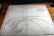
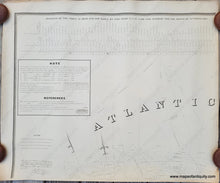
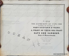
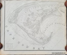
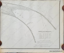
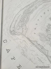
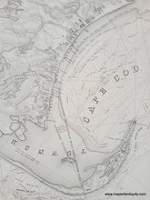
Exquisite, large antique map of Provincetown and Truro, and nautical chart of surrounding waters, produced with information from 1833 to 1835. The image shows four sections which can be put together as one or displayed in four sections. Each sheet measures approximately 29 x 35 inches, total piece measures approx. 56 1/2 x 69 1/2 inches. With information on high and low tides, bathymetric data of off shore areas as well as significant land detail, including landforms, interior water bodies, details of villages and towns. Very good antique condition overall with some mild toning, some small tears, mostly in margins. Please examine the photos closely for full condition information (best viewed on a computer, not mobile, for maximum zoom).

Also available as a full sized reproduction in four sheets for $500 (please contact us by phone or email for the full-sized reproduction), all other options for this map can be found here: REP092.


Item Number: MAS1320