Current hours: 10am to 5pm Tuesday through Saturday. We are closed Sundays and Mondays for the Winter. IMPORTANT PLEASE NOTE: We have become aware that some of our photos have been stolen by other websites. Our maps are only available at our website www.mapsofantiquity.com or at our store!

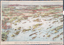
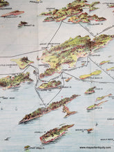
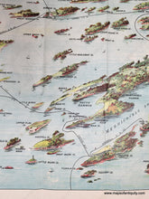
Antique bird's-eye view of part of Casco Bay in Maine with chromolithograph colors in blues, greens, reds, and purples. Red lines show the train routes. Black lines show ferry routes. Portland is on the left side and Mount Washington is in the distance. The islands of Casco Bay are in the foreground.
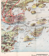
Close up of Portland that is on the left side
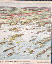
Close up of the islands of Casco Bay that are in the foreground.
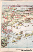
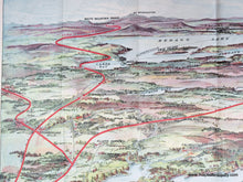
Close up of Mount Washington and Sebago Lake in the distance.
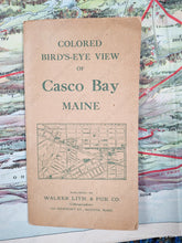
Photo of the original booklet cover that is brown paper with green printing and says Colored Bird's-eye view of Casco Bay Maine Walker Lith & Pub Co
  • Load image into Gallery viewer, Antique bird's-eye view of part of Casco Bay in Maine with chromolithograph colors in blues, greens, reds, and purples. Red lines show the train routes. Black lines show ferry routes. Portland is on the left side and Mount Washington is in the distance. The islands of Casco Bay are in the foreground.
  • Load image into Gallery viewer, Antique bird's-eye view of part of Casco Bay in Maine with chromolithograph colors in blues, greens, reds, and purples. Red lines show the train routes. Black lines show ferry routes. Portland is on the left side and Mount Washington is in the distance. The islands of Casco Bay are in the foreground.
  • Load image into Gallery viewer, Antique bird's-eye view of part of Casco Bay in Maine with chromolithograph colors in blues, greens, reds, and purples. Red lines show the train routes. Black lines show ferry routes. Portland is on the left side and Mount Washington is in the distance. The islands of Casco Bay are in the foreground.
  • Load image into Gallery viewer, Close up of Portland that is on the left side
  • Load image into Gallery viewer, Close up of the islands of Casco Bay that are in the foreground.
  • Load image into Gallery viewer, Close up of the islands of Casco Bay that are in the foreground.
  • Load image into Gallery viewer, Close up of Mount Washington and Sebago Lake in the distance.
  • Load image into Gallery viewer, Photo of the original booklet cover that is brown paper with green printing and says Colored Bird's-eye view of Casco Bay Maine Walker Lith & Pub Co

1906 - Bird's-Eye View of Casco Bay: Portland, Maine and Surroundings - Antique Map

Regular price
$550.00
Sale price
$550.00
Regular price
Sold out
Unit price
per 
Shipping calculated at checkout.

Item number: MAI273

Genuine Antique Map

1906

Maker: Walker

Antique printed-color lithograph of Casco Bay, Maine, by Walker, 1906. Shows Casco Bay from Cape Elizabeth and Portland to Freeport, Brunswick, and Lewiston. Includes the islands, towns, cities, Sebago Lake, Poland Spring House, and Mount Washington in the distance. With ferry and railroad lines. This map was made by George Walker and copyrighted in 1906. Very good overall antique condition with folds as issued. This map is being kept flat in order to reduce the visibility of the folds. Some small separations at the paper edges at the folds. Tight margins on sides as issued. Comes with the original booklet cover that is no longer attached. Map measures 18 x 27.5 inches to the neatline. 

Genuine antique map from 1906.

Item Number: MAI273