Pickup available at 1409 MAIN ST, CHATHAM MA
Usually ready in 24 hours
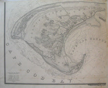
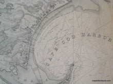
A Map of the Extremity of Cape Cod Township of Provincetown only - Reproduction Map -
-
1409 MAIN ST, CHATHAM MA
Pickup available, usually ready in 24 hours1409 Main Street
Chatham MA 02633
United States+15089451660
Reproduction
High quality black and white reproduction of a portion of an antique harbor chart of Provincetown, 1835. Original map was created in four parts that were joined, and we have reproduced each part. This listing is for the quadrant with Provincetown- if you are interested in the complete reproduction, please contact us. For smaller size complete reproduction please see REP092BP. Printed area for this map measures approx. 31 x 37 inches. Measured to the edges of the printed area. Paper may be larger but can be trimmed as needed. Truro quadrant is also available, please contact us if interested.
Item Number: REP092PT


