Current hours: 10:30am to 5pm Tuesday through Saturday. We are closed Sundays and Mondays for the Winter. IMPORTANT PLEASE NOTE: We have become aware that some of our photos have been stolen by other websites. Our maps are only available at our website www.mapsofantiquity.com or at our store!

Reproduction-Barnstable-Harbor-Massachusetts---Reproduction---Reproduction-Cape-Cod-and-Islands-Reproduction-U.S-Coast-Survey-Maps-Of-Antiquity
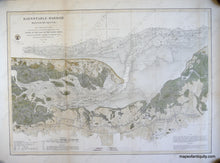
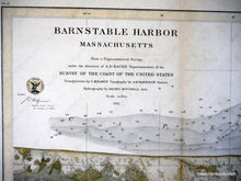
Barnstable Harbor Massachusetts - Reproduction Map
  • Load image into Gallery viewer, Reproduction-Barnstable-Harbor-Massachusetts---Reproduction---Reproduction-Cape-Cod-and-Islands-Reproduction-U.S-Coast-Survey-Maps-Of-Antiquity
  • Load image into Gallery viewer, Barnstable Harbor Massachusetts - Reproduction Map
  • Load image into Gallery viewer, Barnstable Harbor Massachusetts - Reproduction Map

Barnstable Harbor Massachusetts - Reproduction Map -

Regular price
$150.00
Sale price
$150.00
Regular price
Sold out
Unit price
per 
Shipping calculated at checkout.

Item number: REP311
Reproduction

Reproduction

Maker: U.S Coast Survey.

High quality reproduction of antique coastal chart of Barnstable Harbor in 1861, from the U.S. Coast Survey, hand-colored, with beautiful detail of coastal features and topography, and soundings and information on tides and dangers, measures approx. 20.25 X 28.5 inches to the neatline, or 23.5 x 31.5 to the edge of the printed area. Measured to the edges of the printed area. Paper may be larger but can be trimmed as needed.

Item Number: REP311