1884
Maker: Mitchell.
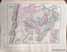
Antique hand colored maps from Mitchell's 1884 New General Atlas. On one side of this page is a map of Europe, on the other side are two maps of South American countries: Chile, Brazil, Bolivia, Paraguay, and Uruguay. Shows railways, political boundaries, cities, water bodies, as well as land features. Colored by country / region. This map is in very good antique condition with minor overall toning. Paper is a bit fragile. Page measures approximately 15 x 12 inches.
Item Number: EUR2667


