Pickup available at 1409 MAIN ST, CHATHAM MA
Usually ready in 24 hours
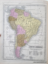
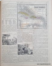
1850 - Double-sided page: South America, verso: West Indies - Antique Map
-
1409 MAIN ST, CHATHAM MA
Pickup available, usually ready in 24 hours1409 Main Street
Chatham MA 02633
United States+15089451660
1850
Maker: Mitchell/ Thomas, Cowperthwait & Co.
Antique map from Mitchell's Intermediate Geography, by Augustus Mitchell and published by Thomas, Cowperthwait & Co. in 1850. Shows countries, cities, some topography. West Indies map is on a page with additional text. Good antique condition with some tiny spots and a tear at the top of the page into the map. South America map measures approx. 10 x 8 inches to the neatline. West Indies map measures approx. 4.5 x 5.25 inches to the neatline. Total page size is 12.25 x 9.25 inches.
Item Number: SAM434


