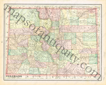
1894
Maker: Cram.
Antique printed color map of Colorado (Recto). Labels Oklahoma as "Ind. Ter." (Indian Territory.) Full, printed color. Verso: Map of Denver. Very good condition with some slight toning at the edges. By Cram, in The Standard Atlas and Gazetteer of The World, 1894. Recto: Approximately 10.25" x 13" to the neatline. Verso: Approx. 10.25" x 13.5" to the neatline.
Item Number: WES214


