Current hours: 10am to 5pm Monday through Saturday. 12pm to 5pm Sundays. IMPORTANT PLEASE NOTE: We have become aware that some of our photos have been stolen by other websites. Our maps are only available at our website www.mapsofantiquity.com or at our store!

Genuine-Antique-Hand-colored-Map-France-Tabula-Delphinatus-Vulgo-Le-Gouvernement-General-du-Dauphine---Homann-Maps-Of-Antiquity
  • Load image into Gallery viewer, Genuine-Antique-Hand-colored-Map-France-Tabula-Delphinatus-Vulgo-Le-Gouvernement-General-du-Dauphine---Homann-Maps-Of-Antiquity
  • Load image into Gallery viewer, Genuine-Antique-Hand-colored-Map-France-Tabula-Delphinatus-Vulgo-Le-Gouvernement-General-du-Dauphine---Homann-Maps-Of-Antiquity

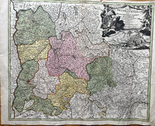
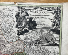
1720 - France - Tabula Delphinatus Vulgo Le Gouvernement General du Dauphine. - Antique Map

Regular price
$195.00
Sale price
$195.00
Regular price
Sold out
Unit price
per 
Shipping calculated at checkout.

Item number: CSMT069
Genuine Antique Hand-colored Map

c. 1720

Maker: Homann


This antique map of the Dauphine Region of France includes Grenoble area, Piemont, Balliage Des Montagnes, Le Bas et Haut Dauphine, up to Lac D'Annecy. Published c. 1720. Measures approx 18 1/2h x 22w" to the neat line, in good overall antique condition with edge-wear, excellent color. Price reflects condition.


Item Number: CSMT069