Current hours: 10am to 5pm Monday through Saturday. 12pm to 5pm Sundays. IMPORTANT PLEASE NOTE: We have become aware that some of our photos have been stolen by other websites. Our maps are only available at our website www.mapsofantiquity.com or at our store!

Genuine-Antique-Map-Framed-France-revised-and-augmented-the-attires-of-the-French-and-situations-of-their-chieftest-cityes-observed-by-John-Speede-1676-Speed-Maps-Of-Antiquity
  • Load image into Gallery viewer, Genuine-Antique-Map-Framed-France-revised-and-augmented-the-attires-of-the-French-and-situations-of-their-chieftest-cityes-observed-by-John-Speede-1676-Speed-Maps-Of-Antiquity
  • Load image into Gallery viewer, Genuine-Antique-Map-Framed-France-revised-and-augmented-the-attires-of-the-French-and-situations-of-their-chieftest-cityes-observed-by-John-Speede-1676-Speed-Maps-Of-Antiquity
  • Load image into Gallery viewer, Genuine-Antique-Map-Framed-France-revised-and-augmented-the-attires-of-the-French-and-situations-of-their-chieftest-cityes-observed-by-John-Speede-1676-Speed-Maps-Of-Antiquity
  • Load image into Gallery viewer, Genuine-Antique-Map-Framed-France-revised-and-augmented-the-attires-of-the-French-and-situations-of-their-chieftest-cityes-observed-by-John-Speede-1676-Speed-Maps-Of-Antiquity
  • Load image into Gallery viewer, Genuine-Antique-Map-Framed-France-revised-and-augmented-the-attires-of-the-French-and-situations-of-their-chieftest-cityes-observed-by-John-Speede-1676-Speed-Maps-Of-Antiquity
  • Load image into Gallery viewer, Genuine-Antique-Map-Framed-France-revised-and-augmented-the-attires-of-the-French-and-situations-of-their-chieftest-cityes-observed-by-John-Speede-1676-Speed-Maps-Of-Antiquity
  • Load image into Gallery viewer, Genuine-Antique-Map-Framed-France-revised-and-augmented-the-attires-of-the-French-and-situations-of-their-chieftest-cityes-observed-by-John-Speede-1676-Speed-Maps-Of-Antiquity

1676 - France, revised and augmented, the attires of the French and situations of their chieftest cityes observed by John Speede - Antique Map

Regular price
$1,175.00
Sale price
$1,175.00
Regular price
Sold out
Unit price
per 
Shipping calculated at checkout.

Item number: EUR2967
Genuine Antique Map, Framed

1676

Maker: Speed

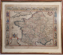
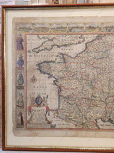
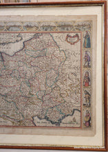
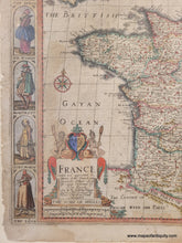
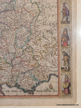
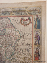
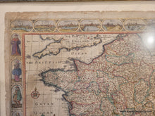
Framed antique map of France by John Speed, 1676. This highly collectible map of France is colored by department with cities labeled and colored red. It features a decorative border with the major cities of France depicted along the top and the clothing styles of various peoples, for men or women, along the sides. The cities at the top are Angiers, Poitiers, Orleans, Paris, Roan (Rouen), Rochelle (La Rochelle), Bordeaux, and Calis (Callais). A highly decorative cartouche and a compass rose are on the left side, and a ship and sea monster decorate the lower right corner. This map is in good to very good antique condition with overall toning, some mild stains, and some paper damage at the edges. Slight paper loss on the left side in the illustration of "G.E. Woman." This map is framed- it seems to have been framed archivally as far as we can tell. The glass is unusual and probably an early iteration of non-glare glass. This map can be shipped unframed if desired (the map price does not change, but the shipping will be less expensive if the map is shipped unframed). Map measures approx. 15.75 x 20.5 inches to the outer border lines. Total size with the frame is 21 x 24.75 inches. **NOTE- because this map requires extra insurance for shipping, we may need to custom calculate the shipping and adjust the shipping paid online. If you would like to know what the total shipping charge will be, please contact us.

Item Number: EUR2967