Current hours: 10am to 5pm Monday through Saturday. 12pm to 5pm Sundays. We are CLOSED on Christmas Day and New Years Day. We will close early (3pm) on Christmas Eve. IMPORTANT PLEASE NOTE: We have become aware that some of our photos have been stolen by other websites. Our maps are only available at our website www.mapsofantiquity.com or at our store!

1874 - Chisholm’s All Round Route And Panoramic Guide To St. Lawrence River Antique Book With

1874 - Chisholm's All Round Route and Panoramic Guide to St. Lawrence River - Antique Book with Maps

Regular price
$350.00
Sale price
$350.00
Regular price
Sold out
Unit price
per 
Shipping calculated at checkout.

Item number: OTH474
Genuine Antique Map

1874

Maker: Chisholm & Co.


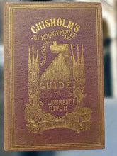
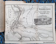
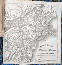
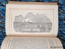
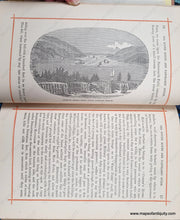
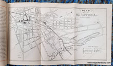
Antique travel book, an 1874 edition of the All-Round Route and Panoramic Guide of the St. Lawrence… by Chisholm & Co., printed by John Lovell. This impressive tourism book includes six maps and it features many woodblock prints showing notable locations. One of the maps depicts the St Lawrence River- it is made of multiple sheets of paper joined and folded and it is 135 inches long when fully unfolded (that's 11.5 feet). This map is oriented with Quebec at the bottom, and Horseshoe Falls at the top. Museums, forts, and hotels are also noted and illustrated on the map. Drawn by Alfred R. Waud. Other maps in the book include Saratoga, NY, the area near Niagara Falls, Excursion Routes via Niagara Falls, a map of the Upper Great Lakes, and a map of the Lower St Lawrence River including Quebec, Montreal, and Ogdensburg near the Thousand Islands. Good antique condition. Binding is sturdy. Maps can be removed for framing if desired. The long map has some spots/foxing that is most notable at the bottom. Other maps are clean. Largest map measures approx. 135 x 6.5 inches to the paper edges. Other maps are smaller, for example the Niagara map is approx. 9.25 x 12.5 inches to the neatline. Note: any "rainbows" or strange patterns in the image are called moire pattern- caused by taking a digital photo or scan of the many parallel lines in the print- these are not in the print and we can try to take more photos if you are concerned. Taking photographs of the long map proved to be difficult and the color seems a bit off. We can try again on request.


Item Number: OTH474