Pickup available at 1409 MAIN ST, CHATHAM MA
Usually ready in 24 hours
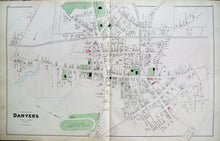
1884 - Village of Danvers, Massachusetts - Antique Map
-
1409 MAIN ST, CHATHAM MA
Pickup available, usually ready in 24 hours1409 Main Street
Chatham MA 02633
United States+15089451660
1884
Maker: Walker.
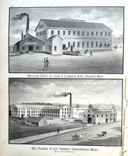
Antique hand colored maps of the Village of Danvers, MA from Walker's 1884 Atlas of Essex County. Side one shows the Village of Danvers, and includes roads, railroads, property owners' names, bodies of water, and public buildings and lands, as well as the Peabody Institute and Danvers Trotting Park. Side two shows black and white illustrations of two local landmarks, John E. Clement & Co., and Geo. Plumer & Co.'s Tannery. Very good overall antique condition with light overall toning, minor light staining. Center spread of Danvers Village measures approx. 16 x 25.5 inches.
Item Number: MAS1646P


