1900
Maker: Cram.
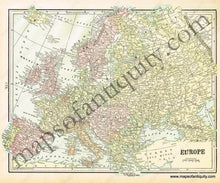
Antique printed color map of Europe (Recto). There is some misalignment in the printing of the title "Europe". Verso: A map of England and Wales. Includes area, population, and a list of chief cities. Very good condition with some slight toning at the edges of the page. By Cram, in Cram's Universal Atlas Geographical, Astronomical and Historical, 1900. Recto map measures approximately 9.75" x 12.5" to the neatline. (Note: Recto map extends past the neatlines at several points- see picture.) Verso map measures approx. 13.5" x 10.5" to the neatline.
Item Number: EUR1876


