Winter hours: Tuesday - Saturday 10am to 5pm. Close Sundays and Mondays until May. We appreciate your business!

Antique-Hand-Colored-Map-Geographical-and-Historical-Map-of-the-Roman-Empire-No.-18-Other--1817-Lavoisne-Maps-Of-Antiquity
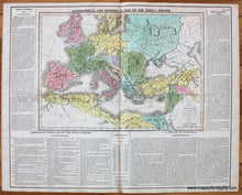
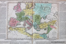
1817 - Geographical and Historical Map of the Roman Empire No. 18 - Antique Map
  • Load image into Gallery viewer, Antique-Hand-Colored-Map-Geographical-and-Historical-Map-of-the-Roman-Empire-No.-18-Other--1817-Lavoisne-Maps-Of-Antiquity
  • Load image into Gallery viewer, 1817 - Geographical and Historical Map of the Roman Empire No. 18 - Antique Map

1817 - Geographical and Historical Map of the Roman Empire No. 18 - Antique Map

Regular price
$150.00
Sale price
$150.00
Regular price
Sold out
Unit price
per 
Shipping calculated at checkout.

Item number: EUR758
Genuine Antique Hand Colored Map

1817

Maker: Lavoisne.

Antique hand colored map of the Roman Empire "Intended for the Elucidation of Lavoisne's Historical Atlas", published by Carey & Sons in the 1817 edition of Lavoisne's Atlas. Features a map colored by country plus detailed descriptions about the Roman Empire. Very good condition with some minor stains, mostly along the center fold. Total dimensions approx. 17.5"h x 22"w, actual map is 10 1/2"h x 15"w.

Item Number: EUR758