Current hours: 10am to 5pm Monday through Saturday. 12pm to 5pm Sundays. IMPORTANT PLEASE NOTE: We have become aware that some of our photos have been stolen by other websites. Our maps are only available at our website www.mapsofantiquity.com or at our store!

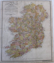
Clans-of-Ancient-Ireland-Print-Reproduction print of an antique map of Ireland showing the five kingdoms of the pentarchy with family names throughout. Topographical and Historical Map of Ancient Ireland
Reproduction print of an antique map of Ireland showing the five kingdoms of the pentarchy with family names throughout. Topographical and Historical Map of Ancient Ireland
  • Load image into Gallery viewer, Clans-of-Ancient-Ireland-Print-Reproduction print of an antique map of Ireland showing the five kingdoms of the pentarchy with family names throughout. Topographical and Historical Map of Ancient Ireland
  • Load image into Gallery viewer, Reproduction print of an antique map of Ireland showing the five kingdoms of the pentarchy with family names throughout. Topographical and Historical Map of Ancient Ireland
  • Load image into Gallery viewer, Reproduction print of an antique map of Ireland showing the five kingdoms of the pentarchy with family names throughout. Topographical and Historical Map of Ancient Ireland

Clans of Ancient Ireland Print - Reproduction -

Regular price
$75.00
Sale price
$75.00
Regular price
Sold out
Unit price
per 
Shipping calculated at checkout.

Item number: REP271BPEUR
Reproduction


Maker: Reproduction.


High Quality Reproduction of a Topographical and Historical Map of Ancient Ireland Shewing the Five Kingdoms of Pentarchy Meath, Ulster, Connaught, Leinster & Munster ... with the old principalities & other chief divisions ... from the 11th to the 17 century... An unusual map showing the ancient clans of Ireland, map compiled by Philip MacDermott and believed to be from The Realities of Irish Life, by W.S. Trench, 1868. Reproduced from an 1856 original, which was a reprint of an 1842 map. Measures about 23.5 x 19 inches. Measured to the edges of the printed area. Paper may be larger but can be trimmed as needed.


Item Number: REP271BPEUR