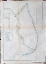
Antique-Map-Sketch-F-Showing-the-Progress-of-the-Survey-in-Section-VI-With-a-General-Reconnoissance-of-the-Western-Coast-of-Florida-1848-1860-Coastal-Report-Chart-U.S.-United-States-Coast-Survey-1860s-1800s-Mid-19th-Century-Maps-of-Antiquity
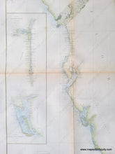
Close-up of part of the coast survey chart of Florida, 1860, showing the west coast and two inset maps. Light green color along the coast and light blue in the water along the coast.
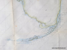
Close-up of part of the coast survey chart of Florida, 1860, showing the south coast and Florida Keys. Light green color along the coast and light blue in the water along the coast.
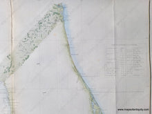
Close-up of part of the coast survey chart of Florida, 1860, showing the east coast and a table of latitudes and longitudes. Light green color along the coast and light blue in the water along the coast.
  • Load image into Gallery viewer, Antique-Map-Sketch-F-Showing-the-Progress-of-the-Survey-in-Section-VI-With-a-General-Reconnoissance-of-the-Western-Coast-of-Florida-1848-1860-Coastal-Report-Chart-U.S.-United-States-Coast-Survey-1860s-1800s-Mid-19th-Century-Maps-of-Antiquity
  • Load image into Gallery viewer, Close-up of part of the coast survey chart of Florida, 1860, showing the west coast and two inset maps. Light green color along the coast and light blue in the water along the coast.
  • Load image into Gallery viewer, Close-up of part of the coast survey chart of Florida, 1860, showing the south coast and Florida Keys. Light green color along the coast and light blue in the water along the coast.
  • Load image into Gallery viewer, Close-up of part of the coast survey chart of Florida, 1860, showing the east coast and a table of latitudes and longitudes. Light green color along the coast and light blue in the water along the coast.

1860 - Florida - Sketch F Showing the Progress of the Survey in Section VI With a General Reconnoissance of the Coast of Florida 1848-1860 - Antique Survey Chart

Regular price
$195.00
Sale price
$195.00
Regular price
Sold out
Unit price
per 
Shipping calculated at checkout.

Item number: SOU372A
Genuine Antique Hand-Colored Coast Survey Chart

1860

Maker: U.S. Coast Survey.


Antique hand-colored coastal report chart of part of Florida, published by the United States Coast Survey, 1860. The diagonal strip with added detail from St Marys to Cedar Keys shows the extent of the surveying done at that time, with triangulation between settlements and towns (such as Gainesville, which wasn't incorporated until 1869). Features two inset maps: St. Johns River and Charlotte Harbor. Includes information regarding locations of astronomical stations, magnetic stations, current stations, tidal stations, etc. Also includes a table of latitudes and longitudes for key points on the coast (e.g. St. Marks Light, Key West Light, etc.) Great representation of Florida Keys. With folds, as issued. Very good overall antique condition with mild toning that is slightly darker along the folds, and a few minor spots. Paper is light-weight and slightly fragile. Measures approximately 24.75" x 16.5" to the neatline.


Item Number: SOU372A