Current hours: 10am to 5pm Tuesday through Saturday. We are closed Sundays and Mondays for the Winter. Proud to be a SMALL, LOCAL, CAPE COD BUSINESS! Maps of Antiquity is in its 38th year! Our maps are only available at our website www.mapsofantiquity.com or at our store!

Hand-Colored-Antique-Coastal-Chart-General-Chart-of-the-Coast-No.-X-Straits-of-Florida-FL-Florida-Keys-United-States-South-1868-U.S.-Coast-Survey-Maps-Of-Antiquity
  • Load image into Gallery viewer, Hand-Colored-Antique-Coastal-Chart-General-Chart-of-the-Coast-No.-X-Straits-of-Florida-FL-Florida-Keys-United-States-South-1868-U.S.-Coast-Survey-Maps-Of-Antiquity
  • Load image into Gallery viewer, Hand-Colored-Antique-Coastal-Chart-General-Chart-of-the-Coast-No.-X-Straits-of-Florida-FL-Florida-Keys-United-States-South-1868-U.S.-Coast-Survey-Maps-Of-Antiquity
  • Load image into Gallery viewer, Hand-Colored-Antique-Coastal-Chart-General-Chart-of-the-Coast-No.-X-Straits-of-Florida-FL-Florida-Keys-United-States-South-1868-U.S.-Coast-Survey-Maps-Of-Antiquity
  • Load image into Gallery viewer, Hand-Colored-Antique-Coastal-Chart-General-Chart-of-the-Coast-No.-X-Straits-of-Florida-FL-Florida-Keys-United-States-South-1868-U.S.-Coast-Survey-Maps-Of-Antiquity
  • Load image into Gallery viewer, Hand-Colored-Antique-Coastal-Chart-General-Chart-of-the-Coast-No.-X-Straits-of-Florida-FL-Florida-Keys-United-States-South-1868-U.S.-Coast-Survey-Maps-Of-Antiquity
  • Load image into Gallery viewer, Hand-Colored-Antique-Coastal-Chart-General-Chart-of-the-Coast-No.-X-Straits-of-Florida-FL-Florida-Keys-United-States-South-1868-U.S.-Coast-Survey-Maps-Of-Antiquity

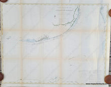
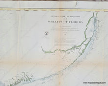
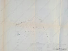
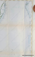
1868 - General Chart of the Coast, No. X, Straits of Florida with hand-coloring - Antique Chart

Regular price
$325.00
Sale price
$325.00
Regular price
Sold out
Unit price
per 
Shipping calculated at checkout.
 More payment options

Pickup available at 1409 MAIN ST, CHATHAM MA

Usually ready in 24 hours

Item number: NAU266HC
Hand Colored Genuine Antique Coastal Chart

1868

Maker: U.S. Coast Survey.


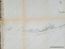
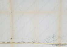
Antique coastal chart of the Florida Keys with beautiful coastal detail and soundings, published by the USCS in 1868 in their annual report. Includes parts of the Bahamas and part of Cuba. With information on light houses and tides. Very good overall antique condition, with mild toning, some small separations, tight margin on left side. Measures approx. 31.25 x 40.75 inches.


Item Number: NAU266HC