Current hours: 10am to 5pm Monday through Saturday. 12pm to 5pm Sundays. We are CLOSED on Christmas Day and New Years Day. We will close early (3pm) on Christmas Eve. IMPORTANT PLEASE NOTE: We have become aware that some of our photos have been stolen by other websites. Our maps are only available at our website www.mapsofantiquity.com or at our store!

Antique-Folding-Road-Map-Without-Cover-Welcome-to-Cape-Cod-Road-Map-and-Directory-Cape-Cod-General-Road-Map-c.-1930s-Cape-Cod-Chamber-of-Commerce-Maps-Of-Antiquity
  • Load image into Gallery viewer, Antique-Folding-Road-Map-Without-Cover-Welcome-to-Cape-Cod-Road-Map-and-Directory-Cape-Cod-General-Road-Map-c.-1930s-Cape-Cod-Chamber-of-Commerce-Maps-Of-Antiquity
  • Load image into Gallery viewer, Antique-Folding-Road-Map-Without-Cover-Welcome-to-Cape-Cod-Road-Map-and-Directory-Cape-Cod-General-Road-Map-c.-1930s-Cape-Cod-Chamber-of-Commerce-Maps-Of-Antiquity
  • Load image into Gallery viewer, Antique-Folding-Road-Map-Without-Cover-Welcome-to-Cape-Cod-Road-Map-and-Directory-Cape-Cod-General-Road-Map-c.-1930s-Cape-Cod-Chamber-of-Commerce-Maps-Of-Antiquity

1930s - Welcome to Cape Cod, Road Map and Directory - Antique Map

Regular price
$75.00
Sale price
$75.00
Regular price
Sold out
Unit price
per 
Shipping calculated at checkout.

Item number: MAS541
Genuine Antique Folding Road Map, With Cover

c. 1930s

Maker: Cape Cod Chamber of Commerce.


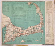
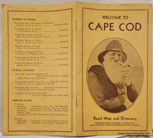
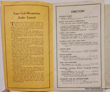
Charming antique folding road map of Cape Cod, printed color, with information on driving distances, summer camps, golf courses, and hotels. Published by the Cape Cod Chamber of Commerce and the Cape Cod, Martha's Vineyard and Nantucket Hotel Associations, c. 1930s. With Directory and Historical Information, information on Golf Courses, Hotels, Summer Camps, and Driving Distances. This map shows Macadam Roads in red- Macadam was an early form of paving invented in the 1820s that offered a smoother ride. The town roads, shown in black, were likely dirt roads. Includes the booklet with directory. Very good condition, mild wear at paper edges, unfolded approx. 12.75 x 12.75 inches.  


Item Number: MAS541