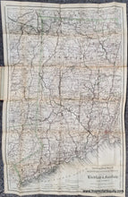
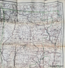
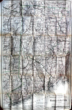
Folding map of Fairfield and Litchfield Counties in Connecticut with the surrounding areas including part of Westchester and Dutchess Counties in NY
1886 - Colton's Road Map of Litchfield and Fairfield Counties of Western Connecticut - Antique Map
Antique-Folding-Map-Colton's-Road-Map-of-Litchfield-and-Fairfield-Counties-of-Western-Connecticut-Connecticut-Folding-Maps-1886-Colton-Maps-Of-Antiquity
1886 - Colton's Road Map of Litchfield and Fairfield Counties of Western Connecticut - Antique Map
  • Load image into Gallery viewer, Folding map of Fairfield and Litchfield Counties in Connecticut with the surrounding areas including part of Westchester and Dutchess Counties in NY
  • Load image into Gallery viewer, 1886 - Colton's Road Map of Litchfield and Fairfield Counties of Western Connecticut - Antique Map
  • Load image into Gallery viewer, 1886 - Colton's Road Map of Litchfield and Fairfield Counties of Western Connecticut - Antique Map
  • Load image into Gallery viewer, 1886 - Colton's Road Map of Litchfield and Fairfield Counties of Western Connecticut - Antique Map
  • Load image into Gallery viewer, 1886 - Colton's Road Map of Litchfield and Fairfield Counties of Western Connecticut - Antique Map
  • Load image into Gallery viewer, Antique-Folding-Map-Colton's-Road-Map-of-Litchfield-and-Fairfield-Counties-of-Western-Connecticut-Connecticut-Folding-Maps-1886-Colton-Maps-Of-Antiquity
  • Load image into Gallery viewer, 1886 - Colton's Road Map of Litchfield and Fairfield Counties of Western Connecticut - Antique Map
  • Load image into Gallery viewer, 1886 - Colton's Road Map of Litchfield and Fairfield Counties of Western Connecticut - Antique Map

1886 - Colton's Road Map of Litchfield and Fairfield Counties of Western Connecticut - Antique Map

Regular price
$450.00
Sale price
$450.00
Regular price
Sold out
Unit price
per 
Shipping calculated at checkout.

Item number: CON198

Genuine Antique Folding Map

1886

Maker: Colton.


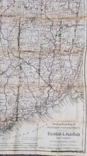
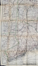
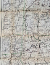
Antique folding road map of Litchfield and Fairfield Counties, Connecticut, with portions of the nearby area, including Westchester, Putnam, and Dutchess Counties in NY and New Haven County CT. There were very few automobiles in existence in 1886 when this map was published, so it is likely that this was a road map for cyclists or other types of travel. Issued as a travel map in a brown-red cover, with gold lettering. Folded in cover, measures about 5.75 x 3.75 inches. Unfolded map measures approx. 30.25 x 19.25 inches to the neatline. This antique map has been restored, cleaned, de-acidified, and re-backed. Very good overall antique condition with some small holes that have been closed during the restoration (see photos) and slight toning. Given some time, the folds should flatten.


Item Number: CON198

Towns in Fairfield County: Bethel Bridgeport Brookfield Cos Cob Danbury Darien Easton Fairfield Georgetown Greenwich Hawleyville Monroe New Canaan New Fairfield Newtown Norwalk Old Greenwich Redding Redding Center Redding Ridge Ridgefield Riverside Sandy Hook Shelton Sherman Southport Stamford Stratford Trumbull Weston Westport Wilton

Towns in Litchfield County: Bantam Barkhamsted Bethlehem Bridgewater Canaan Colebrook Cornwall Cornwall Bridge East Canaan Falls Village Gaylordsville Goshen Harwinton Kent Lakeside Lakeville Litchfield Morris New Hartford New Milford New Preston Marble Dale Norfolk Northfield Oakville Pequabuck Pine Meadow Plymouth Riverton Roxbury Salisbury Sharon South Kent Taconic Terryville Thomaston Torrington Washington Washington Depot Watertown West Cornwall Winchester Center Winsted Woodbury