1856
Maker: Dufour/ Paulin & le Chevalier.
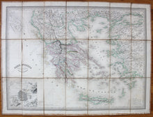
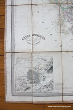
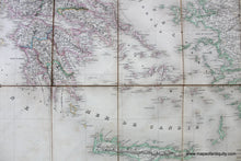
Antique hand colored map of Greece and the Aegean Sea by A. H. Dufour, published by Paulin & le Chevalier, 1856. This map has been divided into sections and mounted on linen, making it foldable. It shows Greece and the many islands, colored by country and region. Includes capitals, towns, villages, and roads with some topography. Inset map of Athens. Good to very good condition with slightly darker toning along the left side, and some tears in the linen. Linen has significant foxing that does not impact the map. Measures approx. 22 x 29.75 inches to the neatline or 24 x 32 inches to the outer edges.
Item Number: EUR2705


