Current hours: 10am to 5pm Monday through Saturday. 12pm to 5pm Sundays. We are CLOSED on Christmas Day and New Years Day. We will close early (3pm) on Christmas Eve. IMPORTANT PLEASE NOTE: We have become aware that some of our photos have been stolen by other websites. Our maps are only available at our website www.mapsofantiquity.com or at our store!

Printed-Color-Antique-Map-Pennsylvania-Folding-Map-by-the-Scarborough-Company-United-States-Pennsylvania-1904-Scarborough-Publishing-Company-Maps-Of-Antiquity
1904 - Pennsylvania Folding Map By The Scarborough Company Antique Printed-Color Genuine
  • Load image into Gallery viewer, Printed-Color-Antique-Map-Pennsylvania-Folding-Map-by-the-Scarborough-Company-United-States-Pennsylvania-1904-Scarborough-Publishing-Company-Maps-Of-Antiquity
  • Load image into Gallery viewer, 1904 - Pennsylvania Folding Map By The Scarborough Company Antique Printed-Color Genuine
  • Load image into Gallery viewer, 1904 - Pennsylvania Folding Map By The Scarborough Company Antique Printed-Color Genuine
  • Load image into Gallery viewer, 1904 - Pennsylvania Folding Map By The Scarborough Company Antique Printed-Color Genuine
  • Load image into Gallery viewer, 1904 - Pennsylvania Folding Map By The Scarborough Company Antique Printed-Color Genuine

1904 - Pennsylvania Folding Map by the Scarborough Company - Antique Map

Regular price
$75.00
Sale price
$75.00
Regular price
Sold out
Unit price
per 
Shipping calculated at checkout.

Item number: MAT123
Printed Color Genuine Antique Map

1904

Maker: Scarborough Publishing Company.

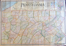
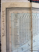
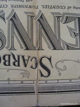
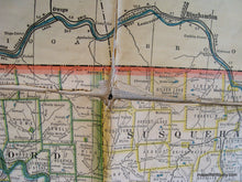
Printed color antique folding map on linen of Pennsylvania made by the Scarborough Company in 1904. Showing all counties, townships, cities, boroughs, villages, post-offices, and Railway Stations with distances between stations in statute miles and decimal fractions of miles. Compiled from the latest government and state surveys and original sources. Showing Steam Railways and suburban Electric Lines and the principal Highway Connections across the mountains. Upper right corner has a table showing the distances saved by the Panama Canal along with three maps of Panama and the canal, as well as a map of the city of Philadelphia. Fair to Poor Antique condition with light minor surface soiling, some seam separation revealing linen backing and some holes in the linen, writing in pen and pencil on upper left corner, overall toning. Approx. 38 x 52 inches when open. Folded size is approx. 10 x 5 inches. Priced in relation to condition.

Item Number: MAT123