Pickup available at 1409 MAIN ST, CHATHAM MA
Usually ready in 24 hours
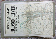
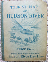
1923 - Tourist Map of the Hudson River - Antique Map
-
1409 MAIN ST, CHATHAM MA
Pickup available, usually ready in 24 hours1409 Main Street
Chatham MA 02633
United States+15089451660
1923
Maker: Rand McNally.
Antique folding map of the Hudson River by Rand McNally & Co., 1923. Shows the Hudson River from Manhattan, New York City to just north of Troy where the Mohawk River meets the Hudson River. Includes railroads, roads, towns, cities, and more. Great detail, yellow shading gives some topography. This is an interesting map because it is 6 x 98 inches! Reproductions could be made of sections of the map. The map is attached at top and bottom to the outer paper jacket and one end would likely need to be separated from the jacket to frame the entire map. Very good condition with some wear to the outer jacket. Measures 6 x 98 inches.
Item Number: NYO918


