Current hours: 10am to 5pm Monday through Saturday. 12pm to 5pm Sundays. IMPORTANT PLEASE NOTE: We have become aware that some of our photos have been stolen by other websites. Our maps are only available at our website www.mapsofantiquity.com or at our store!

Antique-hand-colored-framed-Map-A-Map-of-the-Northern-&-Middle-States;-Comprehending-the-Western-Territory-&-the-British-Dominions-in-north-America.-From-the-Best-Authorities.-North-America--1792-Morse-Maps-Of-Antiquity-1800s-19th-century
  • Load image into Gallery viewer, Antique-hand-colored-framed-Map-A-Map-of-the-Northern-&-Middle-States;-Comprehending-the-Western-Territory-&-the-British-Dominions-in-north-America.-From-the-Best-Authorities.-North-America--1792-Morse-Maps-Of-Antiquity-1800s-19th-century
  • Load image into Gallery viewer, Antique-hand-colored-framed-Map-A-Map-of-the-Northern-&-Middle-States;-Comprehending-the-Western-Territory-&-the-British-Dominions-in-north-America.-From-the-Best-Authorities.-North-America--1792-Morse-Maps-Of-Antiquity-1800s-19th-century
  • Load image into Gallery viewer, Antique-hand-colored-framed-Map-A-Map-of-the-Northern-&-Middle-States;-Comprehending-the-Western-Territory-&-the-British-Dominions-in-north-America.-From-the-Best-Authorities.-North-America--1792-Morse-Maps-Of-Antiquity-1800s-19th-century
  • Load image into Gallery viewer, Antique-hand-colored-framed-Map-A-Map-of-the-Northern-&-Middle-States;-Comprehending-the-Western-Territory-&-the-British-Dominions-in-north-America.-From-the-Best-Authorities.-North-America--1792-Morse-Maps-Of-Antiquity-1800s-19th-century
  • Load image into Gallery viewer, Antique-hand-colored-framed-Map-A-Map-of-the-Northern-&-Middle-States;-Comprehending-the-Western-Territory-&-the-British-Dominions-in-north-America.-From-the-Best-Authorities.-North-America--1792-Morse-Maps-Of-Antiquity-1800s-19th-century
  • Load image into Gallery viewer, Antique-hand-colored-framed-Map-A-Map-of-the-Northern-&-Middle-States;-Comprehending-the-Western-Territory-&-the-British-Dominions-in-north-America.-From-the-Best-Authorities.-North-America--1792-Morse-Maps-Of-Antiquity-1800s-19th-century
  • Load image into Gallery viewer, Antique-hand-colored-framed-Map-A-Map-of-the-Northern-&-Middle-States;-Comprehending-the-Western-Territory-&-the-British-Dominions-in-north-America.-From-the-Best-Authorities.-North-America--1792-Morse-Maps-Of-Antiquity-1800s-19th-century
  • Load image into Gallery viewer, Antique-hand-colored-framed-Map-A-Map-of-the-Northern-&-Middle-States;-Comprehending-the-Western-Territory-&-the-British-Dominions-in-north-America.-From-the-Best-Authorities.-North-America--1792-Morse-Maps-Of-Antiquity-1800s-19th-century
  • Load image into Gallery viewer, Antique-hand-colored-framed-Map-A-Map-of-the-Northern-&-Middle-States;-Comprehending-the-Western-Territory-&-the-British-Dominions-in-north-America.-From-the-Best-Authorities.-North-America--1792-Morse-Maps-Of-Antiquity-1800s-19th-century

1792 - A Map of the Northern and Middle States; Comprehending the Western Territory and the British Dominions in north America. From the Best Authorities. - Antique Map

Regular price
$750.00
Sale price
$750.00
Regular price
Sold out
Unit price
per 
Shipping calculated at checkout.

Item number: NAM265FR
Genuine Antique Map

1792

Maker: Morse.


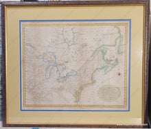
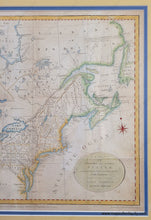
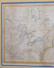
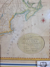
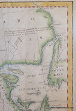
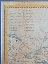
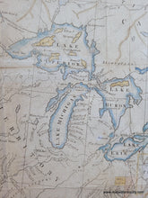
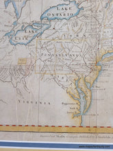
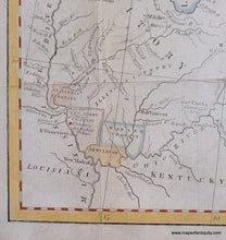
Antique map of part of North America, from Newfoundland to the Mississippi River, and James Bay on the southern end of Hudson Bay to Chesapeake Bay. By Jedidiah Morse, 1792. An interesting depiction of the new country of the United States just after the war. The northeastern boundary goes to Albany Ridge or Mountains of Notre Dame- this was before the Aroostook war determined the boundary of Maine and Canada. Includes interesting old boundaries (such as the Territory of Sagadahock, and squares of land in the western portion that are labeled "army lands, New Jersey Company, Illinois Company, Ohio Company" and more. Labeled states, territories, cities, towns, forts, rivers, mountains, and Dartmouth College. There is a key in the upper left. Very good condition with folds as issued and some minor wrinkles. The printed ink is imperfect and whether that is due to the original printing strike or wear over time, we cannot be sure. Handsomely hand-colored and framed. Framing appears to be archival. Shipping a framed map costs more than shipping an unframed map- this map can be purchased without the frame but the price remains the same. Measures approx. 12.5 x 15.5 inches to the neatline and 19 x 22 inches overall with the frame.


Item Number: NAM265FR