1648
Maker: Johannes Blaeu
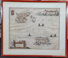
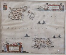
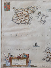
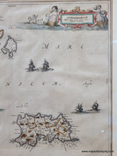
Antique map of the islands of Jersey and Guernsey, two of the Channel Islands in the English Channel, by Blaeu, c. 1648. Features a decorative cartouche with sheep and shepherds and scale of miles with mermaids and merchildren. The "British Sea" is dotted with impressive ships and on the islands are towns, roads, and topography. It is likely that the brown coloring was once green but has changed with time and age. Very good condition with some spots. Framed. The framing does not appear to be archival and the map should be reframed, therefore if it is purchased online, it will be shipped unframed. This map may be attached to a board- please contact us if you are interested and wish to know for sure. It measures approx. 15.25 x 18.5 inches to the neatline. Please forgive the small amounts of glare on the glass in the photos.
Item Number: CSMT147


