Item number: EUR2801
Genuine Antique Hand Colored Map
1640
Maker: Janssonius
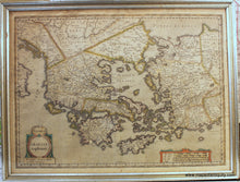
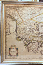
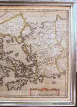
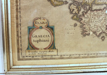
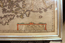
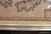
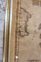
Antique hand colored map of Greece and Western Turkey, c. 1640. This rare map is a later edition of Abraham Ortelius' map, which first appeared in Ortelius' Parergon. After Ortelius' death in 1598, some of his plates were passed on to either Isaac Elsevier or Jodocus Hondius, who partnered with Petrus Bertius and published them in Theatrum Geographiae Veteris. Joannes Janssonius married Elisabeth Hondius, daughter of Jodocus Hondius, in Amsterdam in 1612. After his marriage, he settled down in this town as a bookseller and publisher of cartographic material. In 1631 he began publishing atlases together with Henricus Hondius. In the early 1640s Henricus Hondius left the atlas publishing business completely to Janssonius. The cartography is nearly identical to Ortelius' with a lovely depiction of ancient Greece, western Turkey and the Grecian islands based on the 1545 woodcut map by Nikolaus Sophianos. The notable characteristics of this edition of the map include: handsome and simplified cartouche and scale of distance, sea area filled with dots, and two areas where text has been "removed" from the printing plate at the bottom of the cartouche where it once gave the year 1596 and to the right of the cartouche where previous versions had "Judocus Hondius excudit." It is most similar to the Bertius edition. This map features original color and at some point was trimmed to the neatlines and remargined. It is in good antique condition with some wrinkles, small hole near cartouche, overall toning. Measures approx. 14.25 x 19.5 inches to the neatline. Framed in old frame and should be reframed. **NOTE- because this map is framed, an additional charge for shipping will appear on your card after your original purchase. If you would like to know what that charge will be, please contact us.** Can be shipped unframed- price for the map remains the same but price for shipping would be reduced. Special Sale! Was $800, now $550!
Genuine Antique Map from 1640
Item Number: EUR2801


