1700
Maker: Danckerts
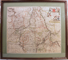
Tabula Episcopatuum Leodiensis et Coloniensis Trevirensis ut et Ducatum Iuliacensis et Montensis Novissima et Accuratissima
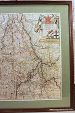
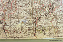
Antique hand colored map of the area of Belgium and Luxembourg to Western Germany, by Theodorus I Danckerts, c.1700. Shows the Lower Rhine and Maas or Meuse Rivers with towns, cities, and villages. Notable cities include Antwerp, Cologne, Bonn, Namur, Burssels, Trier, Mainz, Charleville-Mézières, Ghent, and more. Good to very good antique condition with a center vertical fold that seems to get deeper towards the bottom and has some wear and damage in parts (see photos). Framing appears to be recent and archival. **NOTE- because this map is framed, an additional charge for shipping will appear on your card after your original purchase. If you would like to know what that charge will be, please contact us.** Can be shipped unframed- price for the map remains the same but price for shipping would be reduced.
Item Number: EUR2802


