Current hours: 10am to 5pm Monday through Saturday. Closed on Sundays. IMPORTANT PLEASE NOTE: We have become aware that some of our photos have been stolen by other websites. Our maps are only available at our website www.mapsofantiquity.com or at our store!

Genuine-Antique-Framed-Map-Carte-Gastronomique-de-la-Suisse-Gastronomic-Map-of-Switzerland-1939-Office-National-Suisse-du-Tourisme-a-Zurich-Maps-Of-Antiquity
  • Load image into Gallery viewer, Genuine-Antique-Framed-Map-Carte-Gastronomique-de-la-Suisse-Gastronomic-Map-of-Switzerland-1939-Office-National-Suisse-du-Tourisme-a-Zurich-Maps-Of-Antiquity
  • Load image into Gallery viewer, Genuine-Antique-Framed-Map-Carte-Gastronomique-de-la-Suisse-Gastronomic-Map-of-Switzerland-1939-Office-National-Suisse-du-Tourisme-a-Zurich-Maps-Of-Antiquity
  • Load image into Gallery viewer, Genuine-Antique-Framed-Map-Carte-Gastronomique-de-la-Suisse-Gastronomic-Map-of-Switzerland-1939-Office-National-Suisse-du-Tourisme-a-Zurich-Maps-Of-Antiquity

1939 - Carte Gastronomique de la Suisse, Gastronomic Map of Switzerland - Antique Map

Regular price
$175.00
Sale price
$175.00
Regular price
Sold out
Unit price
per 
Shipping calculated at checkout.

Item number: EUR3044
Genuine Antique Framed Map

1939

Maker: Office National Suisse du Tourisme a Zurich

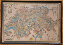
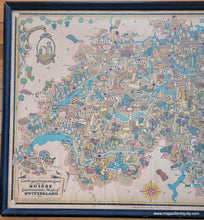
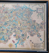
Antique pictorial map of Switzerland printed by Roth & Sauter and published by the Office National Suisse du Tourisme a Zurich in 1939 during the Swiss National Exposition. This map features the delicacies of the country, including cheeses, wines, beers, ciders, bread, meat, chocolate, and more, all shown as inviting illustrations, tempting and tantalizing your tastebuds. The back side features text about the different regions and their specialties. This map is in good to very good condition and framed in an old frame (should be reframed). It has folds as issued and a slight waterstain at the top and bottom edges. Overall toning. Measures approx. 19 x 27 inches to the border line and 21.25 x 29.75 inches to the outer frame edges. This map can be purchased without the frame but the price remains the same.

Item Number: EUR3044