Current hours: 10am to 5pm Monday through Saturday. Closed on Sundays. IMPORTANT PLEASE NOTE: We have become aware that some of our photos have been stolen by other websites. Our maps are only available at our website www.mapsofantiquity.com or at our store!

Antique-Hand-Colored-Map-Xensi-Imperii-Sinarum-Provincia-Secunda-Asia-China-Great-Wall-1655-Blaeu-Maps-Of-Antiquity-1600s-17th-century
  • Load image into Gallery viewer, Antique-Hand-Colored-Map-Xensi-Imperii-Sinarum-Provincia-Secunda-Asia-China-Great-Wall-1655-Blaeu-Maps-Of-Antiquity-1600s-17th-century
  • Load image into Gallery viewer, Antique-Hand-Colored-Map-Xensi-Imperii-Sinarum-Provincia-Secunda-Asia-China-Great-Wall-1655-Blaeu-Maps-Of-Antiquity-1600s-17th-century
  • Load image into Gallery viewer, Antique-Hand-Colored-Map-Xensi-Imperii-Sinarum-Provincia-Secunda-Asia-China-Great-Wall-1655-Blaeu-Maps-Of-Antiquity-1600s-17th-century
  • Load image into Gallery viewer, Antique-Hand-Colored-Map-Xensi-Imperii-Sinarum-Provincia-Secunda-Asia-China-Great-Wall-1655-Blaeu-Maps-Of-Antiquity-1600s-17th-century
  • Load image into Gallery viewer, Antique-Hand-Colored-Map-Xensi-Imperii-Sinarum-Provincia-Secunda-Asia-China-Great-Wall-1655-Blaeu-Maps-Of-Antiquity-1600s-17th-century

1655 - Xensi, Imperii Sinarum Provincia Secunda - Antique Map

Regular price
$495.00
Sale price
$495.00
Regular price
$775.00
Sold out
Unit price
per 
Shipping calculated at checkout.

Item number: CSMT046WI
Genuine Antique Hand Colored Map

1655

Maker: Blaeu.


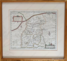
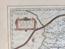
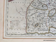
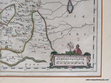
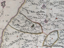
Antique hand colored map of part of China, by Blaeu, 1655. Shows the province Xensi, including the Great Wall. In the lower left is a key for cities and villages, rivers, lakes, fortresses, etc. Decorative distance key includes an illustration of a scholar with an armillary sphere. Published in the 'Novus Atlas Sinensis', the first Western atlas of China, compiled from the maps by Martino Martini, a Jesuit missionary who travelled through China 1643-1650. This map is framed and appears to be in very good condition with some mild foxing and some waviness to the antique paper. Original color- a few areas of green coloring has turned brown and some of that same coloring has degraded the paper and caused separation (see photos). Map measures approx. 15.5 x 19 inches to the neatline. Total dimensions including the frame are approx. 24 x 26.5 inches. For framed items, in store pick up is best, but this can be shipped at an additional cost. Please contact us if you are interested in purchasing without the frame (price will not be affected). **NOTE- because this map requires extra insurance for shipping, an additional charge will appear on your card after your original purchase. If you would like to know what that charge will be, please contact us.**


Item Number: CSMT046WI