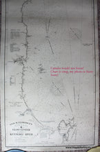
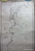
Antique-Coastal-Chart-Gloucester-to-Entrance-of-Kennebec-River-Eldridge-Chart-E**********-United-States-Northeast-1896-George-W.-Eldridge-Maps-Of-Antiquity
1910 - Gloucester to Entrance of Kennebec River, Eldridge Chart E - Antique Chart
  • Load image into Gallery viewer, Antique-Coastal-Chart-Gloucester-to-Entrance-of-Kennebec-River-Eldridge-Chart-E**********-United-States-Northeast-1896-George-W.-Eldridge-Maps-Of-Antiquity
  • Load image into Gallery viewer, 1910 - Gloucester to Entrance of Kennebec River, Eldridge Chart E - Antique Chart
  • Load image into Gallery viewer, 1910 - Gloucester to Entrance of Kennebec River, Eldridge Chart E - Antique Chart
  • Load image into Gallery viewer, 1910 - Gloucester to Entrance of Kennebec River, Eldridge Chart E - Antique Chart

1910 - Gloucester to Entrance of Kennebec River, Eldridge Chart E - Antique Chart

Regular price
$1,800.00
Sale price
$1,800.00
Regular price
Sold out
Unit price
per 
Shipping calculated at checkout.

Item number: NAU114
Genuine Antique Nautical Chart

1910

Maker: George W. Eldridge.

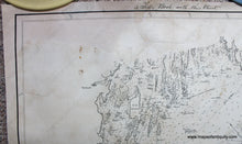
Antique nautical chart of the coast of Maine to Massachusetts, including Casco Bay, Cape Elizabeth, Portsmouth, Isles of Shoals, Plum Island, Portland, and Cape Ann. With bearings and distance of dangers, sailing directions, tidal information, water depths, bathymetric data, etc. Very good condition, strong image, original color for channel markers and lighthouses, restored- cleaned, deacidified, and backed with fabric. Some pencil writing. Some mild signs of age. Measures approx. 73 x 25.5 inches. **NOTE- because this map requires extra insurance for shipping, an additional charge will appear on your card after your original purchase. If you would like to know what that charge will be, please contact us.**

Item Number: NAU114