Winter hours: Tuesday - Saturday 10am to 5pm. Close Sundays and Mondays until May. We appreciate your business!

Hand-Colored-Antique-Coast-Chart-E.-No.-6-Preliminary-Chart-of-Savannah-River-Georgia-sailing-Nautical-1855-U.S.-Coast-Survey-Maps-Of-Antiquity
Hand-Colored-Antique-Coast-Chart-E.-No.-6-Preliminary-Chart-of-Savannah-River-Georgia-sailing-Nautical-Argyle-Island-1855-U.S.-Coast-Survey-Maps-Of-Antiquity
Hand-Colored-Antique-Coast-Chart-E.-No.-6-Preliminary-Chart-of-Savannah-River-Georgia-sailing-Nautical-1855-U.S.-Coast-Survey-Maps-Of-Antiquity
  • Load image into Gallery viewer, Hand-Colored-Antique-Coast-Chart-E.-No.-6-Preliminary-Chart-of-Savannah-River-Georgia-sailing-Nautical-1855-U.S.-Coast-Survey-Maps-Of-Antiquity
  • Load image into Gallery viewer, Hand-Colored-Antique-Coast-Chart-E.-No.-6-Preliminary-Chart-of-Savannah-River-Georgia-sailing-Nautical-Argyle-Island-1855-U.S.-Coast-Survey-Maps-Of-Antiquity
  • Load image into Gallery viewer, Hand-Colored-Antique-Coast-Chart-E.-No.-6-Preliminary-Chart-of-Savannah-River-Georgia-sailing-Nautical-1855-U.S.-Coast-Survey-Maps-Of-Antiquity

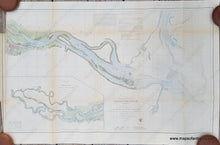
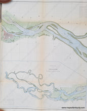
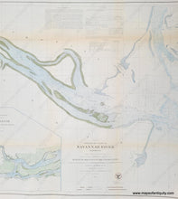
1855 - E. No. 6, Preliminary Chart of Savannah River Georgia - Antique Chart

Regular price
$250.00
Sale price
$250.00
Regular price
Sold out
Unit price
per 
Shipping calculated at checkout.

Item number: SOU129
Hand Colored Genuine Antique Coast Chart

1855

Maker: U.S. Coast Survey.


Beautifully hand colored antique coastal report chart of the Savannah River, Georgia, and coastal area, with inset, Continuation from Savannah to Head of Argyle Island. With bathymetric data, information on tides, currents and sailing directions, as well as beautiful coastal detail. Very good overall antique condition with some minor toning, some mild wrinkles, very slight foxing/spotting. Tight margin and part of the neatline missing on left side (as issued). Measures approx. 29.5 x 33.25 inches. 


Item Number: SOU129