1874
Maker: Gray
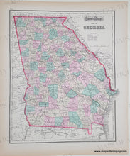
Antique hand colored map of South Carolina with an inset plan of Charleston and its vicinity, including a plan of Fort Sumter. On Verso is antique hand colored map of Georgia. Published in Gray's Atlas, 1874. Both maps include a key and show railroads, common roads, village post offices, etc. at time of publication. Plan of Charleston notes officers quarters, barracks, furnaces for heating shot, powder magazines, the lighthouse, and the landing. Very good antique condition with mild toning of the paper, which is heavier at the outer edges. Map of South Carolina measures approximately 11.75" x 14.75" to the neatline. Map of Georgia measures approx. 14.75" x 11.75" to the neatline, with the map extending slightly past the neatline on the right side.
Genuine Antique Map from 1874
Item Number: SOU571


