1900
Maker: Cram.
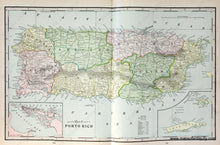
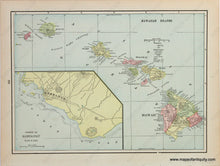
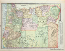
Antique multi-sided map of the island of Puerto Rico with inset maps of San Juan Harbor, and Crab Island & Culebra Island (centerfold.) Versos: Map of the Hawaiian Islands, with an inset map of Honolulu, and map of Oregon. Maps include topographical detail, major cities/towns, etc. Original printed-color. Good to very good overall antique condition with some mild toning at paper edges. Recto map (Puerto Rico) measures approximately 12.75" x 20.75" (H x W) to the neatline. Verso (Hawaiian Islands) measures approx. 10" x 13" to the neatline. Verso of Oregon measures approx. 13 x 10 inches.
Item Number: CAR093


