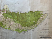
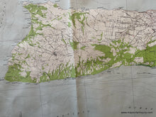
Genuine Antique Topographical Map
1952
Maker: USGS/U.S. Geological Survey
Antique topographic map of the Island of Mokai Hawaii including Mauna Loa, Kaluakoi, Kaluapapa, Molokai Forest Reserve and much more. Good detail and in fair to good antique condition with some edge wear and shadows from discoloration/toning and minor staining, some creasing. The sheet size measures approximately 21"h x 47"w.
Item Number: TOP100


