Genuine-Antique-Topographical-Map-Haiku-Hawaii-Topo-Map-1957-USGS-U-S--Geological-Survey-Maps-Of-Antiquity
  • Load image into Gallery viewer, Genuine-Antique-Topographical-Map-Haiku-Hawaii-Topo-Map-1957-USGS-U-S--Geological-Survey-Maps-Of-Antiquity
  • Load image into Gallery viewer, Genuine-Antique-Topographical-Map-Haiku-Hawaii-Topo-Map-1957-USGS-U-S--Geological-Survey-Maps-Of-Antiquity

1957 - Haiku Hawaii Topo Map - Antique Map

Regular price
$40.00
Sale price
$40.00
Regular price
Sold out
Unit price
per 
Shipping calculated at checkout.

Item number: TOP101
Genuine Antique Topographical Map

1957

Maker: USGS/U.S. Geological Survey

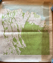
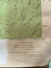
Antique topographic map of Haiku Quadrangle Hawaii, Island and County of Maui, 7.5 Minute Series. This interesting topographic map is in fair to poor condition because of its pronounced toning on the right side, center crease, and a noticable repair in the upper right corner. The map shows roadways and forest including the Koolau Forest Reserve and the sheet size measures approximately 26 3/4"h x 24"w.

Item Number: TOP101