Winter hours: Tuesday - Saturday 10am to 5pm. Close Sundays and Mondays until May. We appreciate your business!

Genuine-Antique-Map-Hawaii-Hawaiian-Islands-1901-Hawaii-Territory-Survey-Maps-Of-Antiquity
  • Load image into Gallery viewer, Genuine-Antique-Map-Hawaii-Hawaiian-Islands-1901-Hawaii-Territory-Survey-Maps-Of-Antiquity
  • Load image into Gallery viewer, Genuine-Antique-Map-Hawaii-Hawaiian-Islands-1901-Hawaii-Territory-Survey-Maps-Of-Antiquity
  • Load image into Gallery viewer, Genuine-Antique-Map-Hawaii-Hawaiian-Islands-1901-Hawaii-Territory-Survey-Maps-Of-Antiquity
  • Load image into Gallery viewer, Genuine-Antique-Map-Hawaii-Hawaiian-Islands-1901-Hawaii-Territory-Survey-Maps-Of-Antiquity
  • Load image into Gallery viewer, Genuine-Antique-Map-Hawaii-Hawaiian-Islands-1901-Hawaii-Territory-Survey-Maps-Of-Antiquity

1901 - Hawaii, Hawaiian Islands - Antique Map

Regular price
$550.00
Sale price
$550.00
Regular price
Sold out
Unit price
per 
Shipping calculated at checkout.

Item number: WES475
Genuine Antique Map

1901

Maker: Hawaii Territory Survey

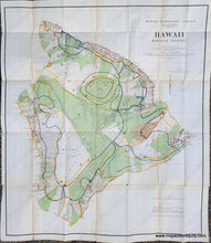
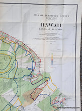
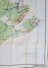
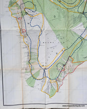
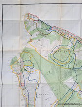
Antique folding map of the Big Island of Hawaii, by John M. Donn for the Hawaii Territory Survey, 1901, and prepared for the 1906 Report of the Governor of the Territory of Hawaii to the Secretary of the Interior. This notable map was one of the most detailed maps of the island at the time and its focus was on land development and administration. It has printed color with exquisite detail of topographic features, and a colored legend indicating public lands, pineapple lands, sugar plantations, forest reserves, etc. On this map are Mauna Loa and other mountains, towns and cities, and more. This rare map does not appear on the market often and is an exciting find. With folds as issued. It is in good antique condition, with some wear along the fold lines and small separations at some of the fold intersections. Measures approx. 36.5h x 31.5w inches.

Item Number: WES475