Winter hours: Tuesday - Saturday 10am to 5pm. Close Sundays and Mondays until May. We appreciate your business!

Antique-Hand-Colored-Map-Illinois-Missouri-Indiana-Midwest-Illinois-1874-Gray-Maps-Of-Antiquity
1874 - Illinois, Missouri, Indiana - Antique Map
  • Load image into Gallery viewer, Antique-Hand-Colored-Map-Illinois-Missouri-Indiana-Midwest-Illinois-1874-Gray-Maps-Of-Antiquity
  • Load image into Gallery viewer, 1874 - Illinois, Missouri, Indiana - Antique Map
  • Load image into Gallery viewer, 1874 - Illinois, Missouri, Indiana - Antique Map

1874 - Illinois, Missouri, Indiana - Antique Map

Regular price
$150.00
Sale price
$150.00
Regular price
Sold out
Unit price
per 
Shipping calculated at checkout.

Item number: MWE203
Genuine Antique Hand Colored Map

1874

Maker: Gray.

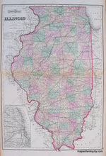
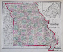
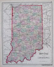
Hand Colored Antique double-sided map from "Gray's Atlas of the U.S. with General Maps of the World". The larger map on one side is Gray's Atlas Map of Illinois with inset of the Plan of Cook County & Vicinity. The opposite side has two maps, one is Gray's Atlas Map of Missouri with inset of St Louis, the other is Gray's Atlas Map of Indiana. Each map shows townships, towns, cities, land forms, rivers, bodies of water, and railroads. Very Good Antique condition, two creases at center, toning on edges. Approx. 16.5 x 27 inches. Missouri and Indiana maps are approx. 12 x 15 and cost $95 each.

Item Number: MWE203