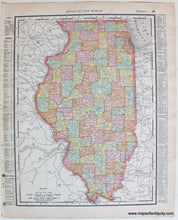
1895
Maker: Rand McNally.
Antique printed color map of Chicago (Recto.) On Verso: Illinois. Chicago map includes names of major streets, parks, cemeteries, etc. Inset map of the greater Chicago area. Text in margins is a key to the points of interest and streets. Illinois map is colored by county and shows cities, towns, railroads, etc. Text in margins is a key to the counties, cities, and populations. Very good overall antique condition with some minor toning and a few spots at paper edge. Tight margin on one side. By Rand McNally, 1895. Recto map (Chicago) measures approximately 12.5" x 9.25" (H x W) to the neatline. Verso map (Illinois) measures approx. 12.5" x 9.25" to the neatline.
Item Number: TOW607


