Current hours: 10am to 5pm Monday through Saturday. Closed on Sundays. IMPORTANT PLEASE NOTE: We have become aware that some of our photos have been stolen by other websites. Our maps are only available at our website www.mapsofantiquity.com or at our store!

Antique-Printed-Color-Map-Virginia-and-West-Virginia-verso:-Illinois-and-Iowa-******-North-America-Mid-Atlantic-Midwest-1900-Cram-Maps-Of-Antiquity
  • Load image into Gallery viewer, Antique-Printed-Color-Map-Virginia-and-West-Virginia-verso:-Illinois-and-Iowa-******-North-America-Mid-Atlantic-Midwest-1900-Cram-Maps-Of-Antiquity
  • Load image into Gallery viewer, Antique-Printed-Color-Map-Virginia-and-West-Virginia-verso:-Illinois-and-Iowa-******-North-America-Mid-Atlantic-Midwest-1900-Cram-Maps-Of-Antiquity
  • Load image into Gallery viewer, Antique-Printed-Color-Map-Virginia-and-West-Virginia-verso:-Illinois-and-Iowa-******-North-America-Mid-Atlantic-Midwest-1900-Cram-Maps-Of-Antiquity

1900 - Virginia and West Virginia, verso: Illinois, and Iowa - Antique Map

Regular price
$75.00
Sale price
$75.00
Regular price
Sold out
Unit price
per 
Shipping calculated at checkout.

Item number: MAT182
Genuine Antique Printed Color Map

1900

Maker: Cram.


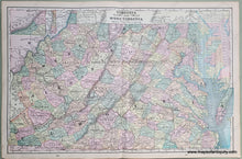
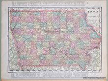
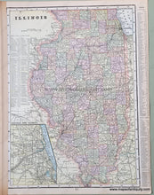
Antique printed color double-sided sheet of Virginia and West Virginia (centerfold). Includes an inset map to show the Western-most portion of Virginia, as well as a list of counties and chief cities for both states. Verso: (Two maps) A map of Illinois, which features an inset map of Chicago and vicinity, and a map of Iowa. Both of these include lists of counties and chief cities as well. Very good condition with some slight overall toning and a very mild water stain at a corner of the pages. By Cram, in Cram's Universal Atlas Geographical, Astronomical and Historical, 1900. Recto Map (Virginia and West Virginia) measures approximately 20.5" x 13.25" to the neatline. Illinois Map measures approx. 13.5" x 9.75" to the neatline. (Note: List of Counties and part of the list of chief cities lie outside the neatlines of the Illinois Map.) Map of Iowa measures approx. 9" x 12.75" to the neatline. (Note: List of counties and chief cities lies entirely outside of the neatlines of the Iowa Map.) 


Item Number: MAT182