Winter hours: Tuesday - Saturday 10am to 5pm. Close Sundays and Mondays until May. We appreciate your business!

Antique-Map-Hempstead-New-York-verso-Pearsalls-East-Rockaway-Rockville-Centre-Christian-Hook-New-York-Long-Island-Maps-of-Antiquity
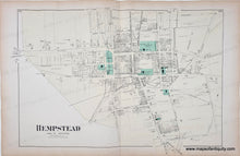
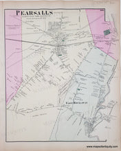
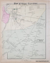
1873 - Hempstead, New York, verso Pearsalls/East Rockaway, Rockville Centre/Christian Hook (NY) - Antique Map
  • Load image into Gallery viewer, Antique-Map-Hempstead-New-York-verso-Pearsalls-East-Rockaway-Rockville-Centre-Christian-Hook-New-York-Long-Island-Maps-of-Antiquity
  • Load image into Gallery viewer, 1873 - Hempstead, New York, verso Pearsalls/East Rockaway, Rockville Centre/Christian Hook (NY) - Antique Map
  • Load image into Gallery viewer, 1873 - Hempstead, New York, verso Pearsalls/East Rockaway, Rockville Centre/Christian Hook (NY) - Antique Map

1873 - Hempstead, New York, verso Pearsalls/East Rockaway, Rockville Centre/Christian Hook (NY) - Antique Map

Regular price
$150.00
Sale price
$150.00
Regular price
Sold out
Unit price
per 
Shipping calculated at checkout.

Item number: NYO030
Genuine Antique Hand Colored Map

1873

Maker: Beers.

From the Atlas of Long Island, New York, Hempstead, Queens, with churches, parks, property owners, by D.G. Beers & Co., 1873. Measures approx. 13.5 x 20.5 inches. Fair to Good overall antique condition with mild toning throughout, a few spots of minor foxing, minor image overlay, minor seam separation at the bottom of the fold, and many tears/minor paper loss at the outer edges. *Note: Priced As Is.

Item Number: NYO030